Full Article
about La Garganta
The highest village in the Ambroz; known for its winter snow and the wolf.
Hide article Read full article
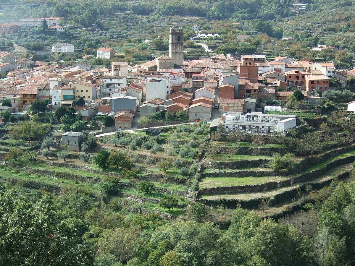
By mid-afternoon, as the sun drops towards the slopes of the sierra, light enters La Garganta at an angle and settles on its stone walls and dark roof tiles. At that hour the village is almost silent. A dog barks somewhere below, wind moves through nearby chestnut trees, footsteps crunch on gravel. The setting is over a thousand metres above sea level, in the upper part of the Valle del Ambroz, and that sense of distance from everything else is hard to miss.
The village itself is small and can be walked at an unhurried pace in about twenty minutes. At its centre stands the parish church of Santa María, built in granite and topped with curved roof tiles. Around it stretch narrow streets where worn wooden gates and barely visible inner courtyards appear one after another. Some houses still display coats of arms carved into stone, others have wooden balconies darkened by long winters.
Homes here follow a clear mountain logic. Thick walls, modest windows and sloping roofs designed to cope with snow and rain. On many terraces there are still small vegetable plots or pots with herbs. Nothing feels arranged for display. It all seems built to endure the climate.
Short streets, slow rhythm
Most of the activity gathers along a handful of streets that slope down towards the main square. There are no eye-catching shopfronts or signs aimed at visitors. Instead, the details are quieter. Hand-forged iron grilles, exterior stone staircases, large gates opening straight into yards or interior patios.
A slow walk is enough to understand how the village has worked over generations. Everything is close together, and everything faces the mountain.
Paths through chestnut and oak
Leaving the built-up area, especially to the west, paths begin to thread into the forest. These are old routes that follow stone boundaries and small plots of land. Signposting is not always clear, so some attention is needed if the area is unfamiliar.
In autumn the ground is covered with leaves from chestnut and oak trees, and certain stretches can be quite slippery. Footwear with a firm sole makes a difference, particularly after rain.
Slopes appear quickly. The routes are not long in distance, but they involve steady climbs. As height is gained, clearings open up. On bright days, it is possible to see the peaks of the Sierra de Gredos in the distance, their outlines sharp against the horizon.
Autumn of mushrooms and chestnuts
When the wetter weeks of autumn arrive, people from the surrounding area head up into the nearby hills to look for mushrooms. Wicker baskets appear, and walkers move slowly beneath the chestnut trees, eyes fixed more on the ground than the landscape.
Well-known varieties such as níscalos, a type of saffron milk cap mushroom, can be found, along with many amanitas, some edible and others not. Those without experience tend to come with someone who knows the terrain, or simply observe. At that time of year, the forest floor becomes a patchwork of orange, brown and yellow caps scattered among dry ferns.
Chestnuts define the season too. As the colder weather sets in, they are often roasted over embers, releasing a sweet, toasted smell that lingers in the air and on clothing.
When to go, and when to think twice
Spring and autumn are usually the most comfortable times to walk in the surrounding area. The forest shifts in colour and temperatures allow for long, easy walks.
Winter mornings often bring heavy frost. Streets can be coated in ice, and some paths become harder to manage. Summer, on the other hand, brings bright days, though the sun can feel intense at midday in exposed areas. Early starts or late afternoon walks tend to be more manageable.
During autumn weekends, when the valley attracts more visitors, arriving early helps if you want to park near the centre. Streets are narrow and space is limited.
A pause in the Valle del Ambroz
La Garganta is not a large place, nor does it gather a long list of monuments. It is a small cluster of streets high in the sierra, with forest beginning almost at the last house. Its appeal lies more in the pace of the place than in a checklist of sights.
It works well as a quiet stop within a broader route through the Valle del Ambroz. A short walk through the village, some time among chestnut trees, and that mountain silence that appears as soon as you move a little away from the final row of houses.
To reach it from Cáceres, the usual route is along the A‑66 towards the area of Plasencia, then continuing along the roads that cross the valley in the direction of Hervás. The final stretch climbs with a series of bends, and the road is not especially wide, so it is best taken steadily, particularly on days of rain or fog.
