Full Article
about A Merca
Hide article Read full article
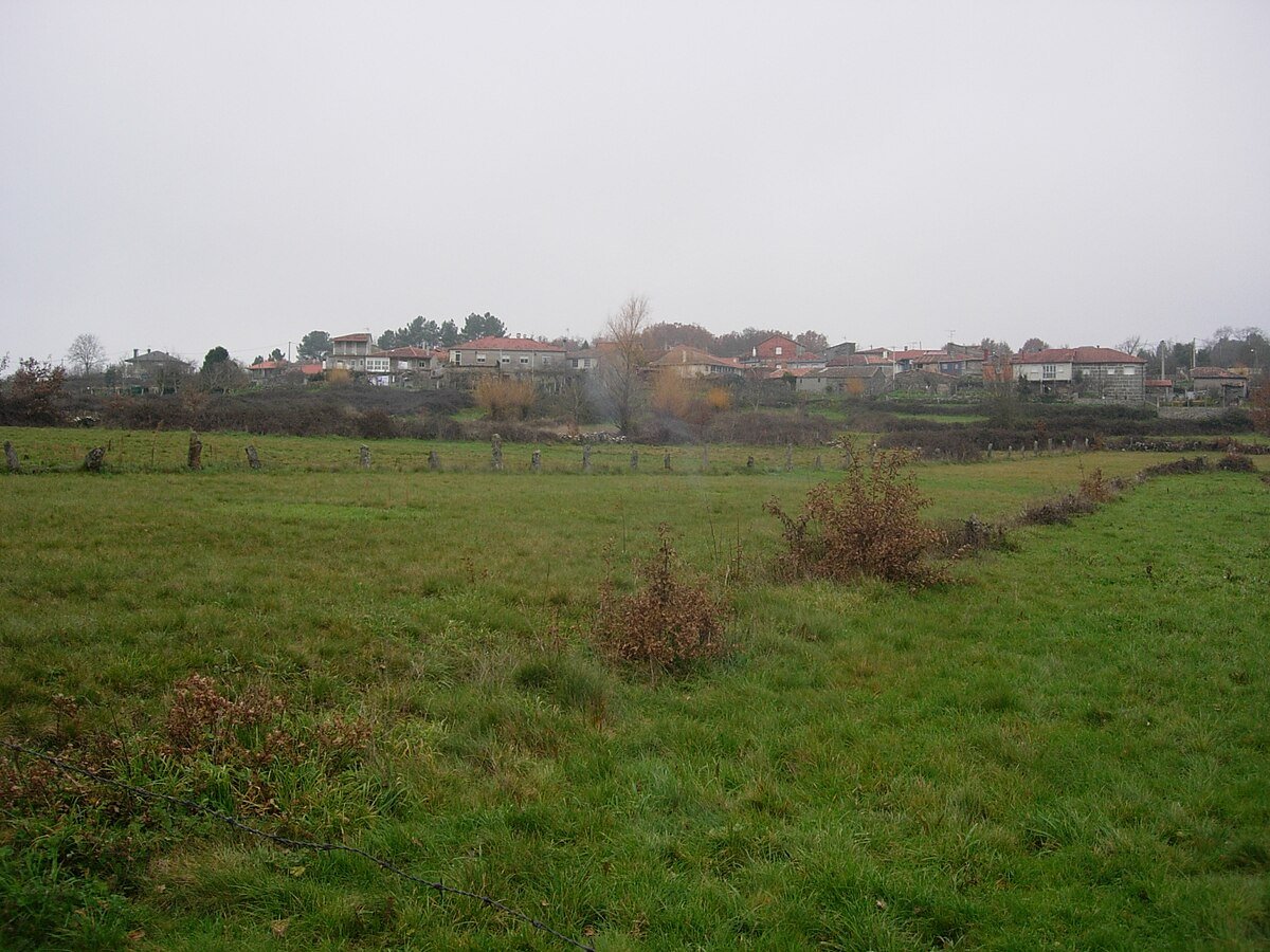
A Landscape of Parishes and Hills
A Merca sits in the central part of the Allariz‑Maceda comarca, in the south of the province of Ourense. It does not function as a single, compact town. Instead, it is made up of a collection of parishes and small villages scattered across gentle hills. That pattern of settlement shapes the entire area. Stone houses appear spaced out rather than clustered, narrow roads wind between them, and small plots of land still define the rhythm of everyday life.
This is not a place built around a central square or a clear urban core. Movement through A Merca means travelling between points rather than arriving at one. The distances on a map may look short, yet the layout stretches them out in practice, as local roads curve between fields and wooded areas.
Granite, Stone and Everyday Structures
Granite dominates both the landscape and the built environment. It is present in walls, gateways and hórreos, the raised granaries typical of Galicia, and it also appears naturally along the edges of paths. The same material repeats itself across the municipality, tying together houses, agricultural structures and the terrain itself.
In many villages, cruceiros can be found. These are traditional stone crosses, often placed at crossroads or near churches, and they still hold a place in local life. Nearby, small churchyards or atrios act as gathering points at certain times of the year, maintaining a social function that goes beyond their religious role.
The parish church of Santiago de A Merca stands at the centre of the main settlement. Its origins are usually dated to the 16th century, with later alterations. It is not a monumental building in architectural terms. Its importance lies more in how it has served the surrounding community. As in many inland areas of Ourense, the church and its atrio continue to act as a reference point for nearby parishes.
Traces of Agricultural Life
Moving through A Merca reveals a landscape closely tied to agriculture. Elements linked to daily rural work appear frequently and naturally along the way. There are communal washing places beside paths, hórreos lined up near houses, and field boundaries built from dry stone, carefully stacked without mortar.
These are not isolated features preserved for display. They form part of a wider network that, in some places, remains in use. Together they reflect a way of life that has adapted over time but has not disappeared entirely.
The rural paths that connect the villages pass through meadows and small carballeiras, oak groves typical of Galicia. There are no major changes in elevation, although the terrain can become more challenging in wet conditions. Granite surfaces turn slippery when it rains, and the earth along some tracks softens underfoot. Anyone walking along these paths needs to take that into account, as the ground itself sets the limits.
Food and Seasonal Rhythms
Local cooking follows the same rural logic as the landscape. Pork products play a central role, especially cured meats and dishes associated with the traditional matanza, the seasonal slaughter that has long been part of agricultural life.
There are also recipes tied to specific times of year. Lacón con grelos, a dish made with pork shoulder and turnip greens, appears when the colder months arrive. In many households, these meals are still connected to the agricultural calendar, rather than being prepared independently of it.
Food here is not separate from the land. It reflects the same cycles and resources that shape the fields and villages.
Nearby Places and Moving Around
Close to A Merca, several places help to provide a broader understanding of the area. Celanova preserves one of the most important monastic complexes in the province, linked to San Rosendo. It offers a different perspective, with a stronger emphasis on historical architecture.
Further south, the surroundings of the As Conchas reservoir and the area of Bande present another side of inland Ourense. The landscape opens out, and there are historical remains that contrast with the more enclosed, village-based structure of A Merca.
Within the municipality itself, it is worth keeping in mind that this is not somewhere to explore as a single, walkable centre. The villages are separated by several kilometres, and the local roads wind between fields and wooded areas. Journeys often take longer than expected because of these curves.
With limited time, focusing on the main settlement and walking along one of the paths leading towards nearby villages gives a clear sense of the place. Within a short distance, hórreos, washing places and cruceiros begin to appear, helping to explain how the municipality is organised.
One common mistake is trying to reach every small point on the map by car. Many of the tracks are narrow, and passing another vehicle is not always straightforward. When in doubt, it is usually better to leave the car in the village and continue on foot.
In wet weather, footwear with good grip becomes important. Granite and damp soil can be unpredictable, and conditions change quickly. In A Merca, the terrain continues to set the rules, just as it always has.