Full Article
about Coristanco
Hide article Read full article
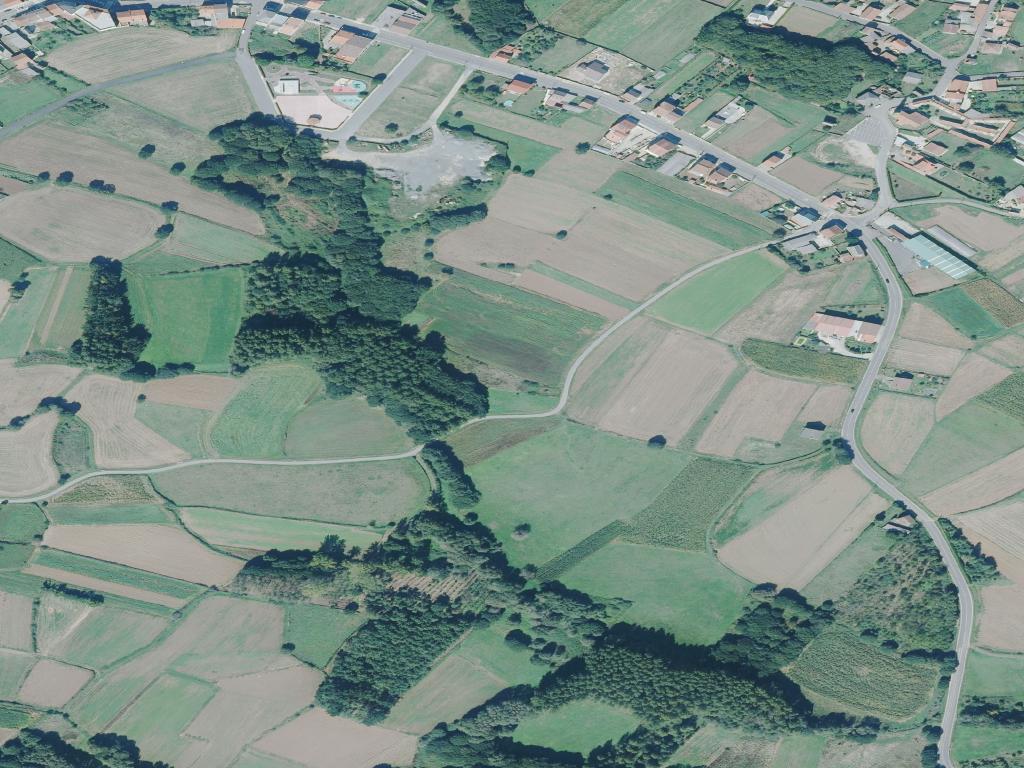
Talking about tourism in Coristanco means starting with the land itself. In the comarca of Bergantiños, the land has shaped daily life for centuries. This municipality grew around a balance of rivers, fertile fields and the routes that linked the interior with the Atlantic coast. The valley of the Lubiáns organises much of the landscape. Around it, small and scattered villages took root, and their layout still explains how people have lived here over generations.
In several stretches of the river there are remains of old stone crossings. Local tradition attributes one of them to Roman times, associating it with the routes that once followed the Atlantic coastline. Documentary evidence is limited, yet one thing is clear: this river corridor was used from an early period to travel between the ports along the coast and the inland area of Bergantiños.
A Landscape Shaped by Work
Coristanco is one of the larger municipalities in the comarca. It does not revolve around a single dominant centre. Instead, it is formed by a network of parishes and hamlets, separated by cultivated fields, small patches of woodland and a constant weave of rural roads.
This agricultural landscape is not recent. Medieval documents already refer to cultivated land in these fertile lowlands, many plots linked to monasteries and local lordships. The productivity of the Lubiáns valley ensured continuous use, with small parcels adapted over time to changing needs and techniques.
Today the most visible crop is the potato. That prominence is no coincidence. In Galicia, the potato spread widely between the eighteenth and nineteenth centuries, when it shifted from being an American curiosity to a staple food in the countryside. In Bergantiños it found damp, loose soils well suited to its growth, and in Coristanco it became one of the municipality’s defining crops.
By late summer the appearance of the valley changes. Sacks are stacked at the edges of fields. Tractors move steadily along narrow lanes. There is constant activity on rural tracks as the harvest comes in. The rhythm of work is visible in the landscape itself.
Ancient Footprints on Gentle Hills
Long before the current parish structure took shape, people had already settled on these soft hills. Several sites within the municipality preserve remains of castros, fortified settlements from the Iron Age that once overlooked the valleys. They are usually positioned on modest rises, high enough to control the natural routes towards the coast without dominating the skyline.
From some of these elevated points, on clear days, it is possible to glimpse the strip of sea towards Corme and Laxe. That visual link between inland territory and shoreline has historically defined the area. The coast provided salt and fish. The interior supplied grain, livestock and vegetables from the market gardens.
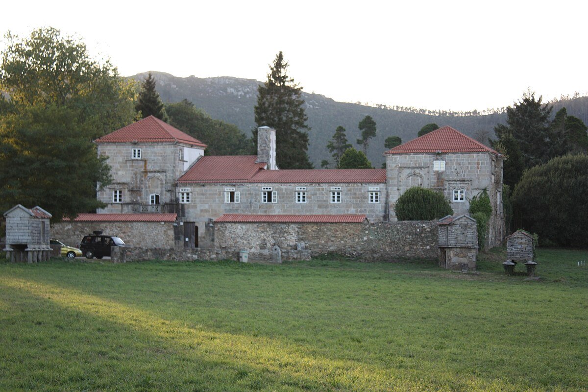
During the Middle Ages the territory was reorganised into parishes, many of which still exist today. The churches that stand now are often the result of later alterations, yet the parish boundaries themselves are old. Around these parish churches, collective life was concentrated for centuries. Fairs were held there. Neighbours gathered to discuss local matters. Religious celebrations punctuated the year.
The parish system remains one of the keys to understanding Coristanco. Rather than a compact town centre, what emerges is a dispersed pattern of communities, each with its own church and surrounding farmland.
Romerías and the Rural Calendar
The festive calendar still follows an agricultural logic. When the summer romerías arrive, many coincide with specific moments in the farming cycle or with the end of particular harvests. A romería is a traditional Galician pilgrimage festival that blends religious devotion with social gathering, often centred on a local saint.
The romería of San Roque, which has a strong presence in the municipality, brings together residents from several parishes each August. The day combines acts of devotion with a shared meal, a format that has been common in Galicia for generations. It is not conceived as a visitor attraction. It functions above all as an annual meeting point for people from the area.
Something similar happens with the celebration dedicated to the potato. It began as a fair linked directly to the crop. Farmers and neighbours come together around the product that has shaped the local economy for decades. The atmosphere resembles a day in the countryside more than a tourist event. The focus remains on the harvest and on the community that depends on it.
These gatherings reflect the same pattern seen in the fields. Agricultural work sets the tempo, and festivities fit around it.
Moving Through a Dispersed Municipality
Coristanco is not experienced as a single, compact village. It is a dispersed municipality, with parishes separated by several kilometres. For that reason, travelling by car is usually the most practical option.
The main communication axis runs through San Roque, where services and administrative buildings are concentrated. From there, local roads branch off towards outlying villages and farming areas. The sense of space between settlements becomes clear as soon as one leaves this central point.
Those who prefer to explore on foot can head towards the surroundings of the Lubiáns river. Paths that follow the watercourse allow close views of the cultivated lowlands and of the small traditional bridges that once linked fields and hamlets. In winter, waterproof footwear is advisable, as the ground easily becomes muddy.
Coristanco does not operate as a destination defined by isolated monuments. It is better understood by moving slowly along its roads and tracks, paying attention to how the territory is organised. The parishes, the crops, the old river crossings and the pattern of settlement together reveal the history of the place. The story of Coristanco lies in its fields and in the way the landscape continues to reflect centuries of work.