Full Article
about Vilasantar
Hide article Read full article
A Landscape of Parishes
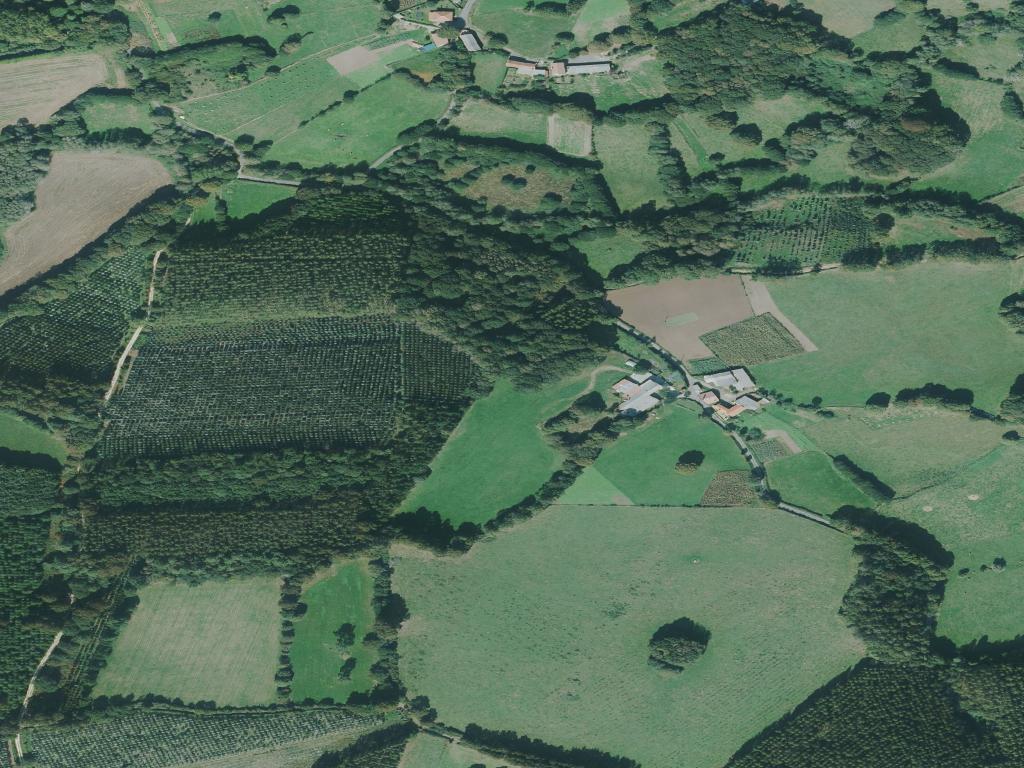
Vilasantar is a municipality without a town. Its identity is dispersed across a dozen parishes, each a cluster of granite houses and a church, separated by fields and oak groves. The administrative centre is scarcely more than a crossroads. To understand this place, you must move through it, from one small settlement to the next.
The underlying structure is medieval, tied to the historical influence of Betanzos to the west. The territory has always been organised this way: not as a nucleus, but as a constellation of rural communities. This is not a design for visitors, but a result of how land was worked and inhabited for centuries.
Architecture of Granite and Purpose
The parish churches anchor the landscape. Most were rebuilt or significantly modified between the 16th and 18th centuries, using the local granite that defines everything here. Their architecture is sober, even severe, with ornamentation kept to a minimum. The church of San Paio de Becés is typical—a solid volume with a simple bell gable, its older origins visible only in certain proportions.
Domestic architecture follows the same logic of utility. The older houses are built with thick stone walls and steeply pitched roofs to shed the Atlantic rain. Some retain the corredor, a wooden gallery on the south-facing façade. This was not for leisure; it was a practical space for drying corn or chestnuts.
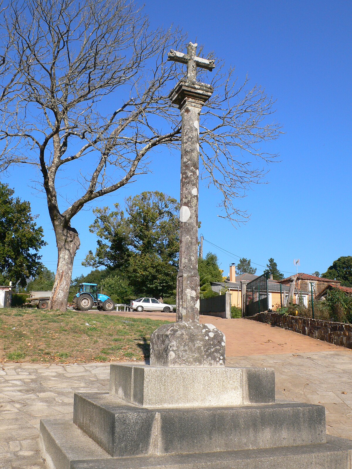
You see this functionality repeated in the stone hórreos (granaries), the low boundary walls built without mortar, and the cruceiros (stone crosses) that mark paths and crossroads. They are elements of a working landscape, not placed for decoration.
Navigating a Dispersed Territory
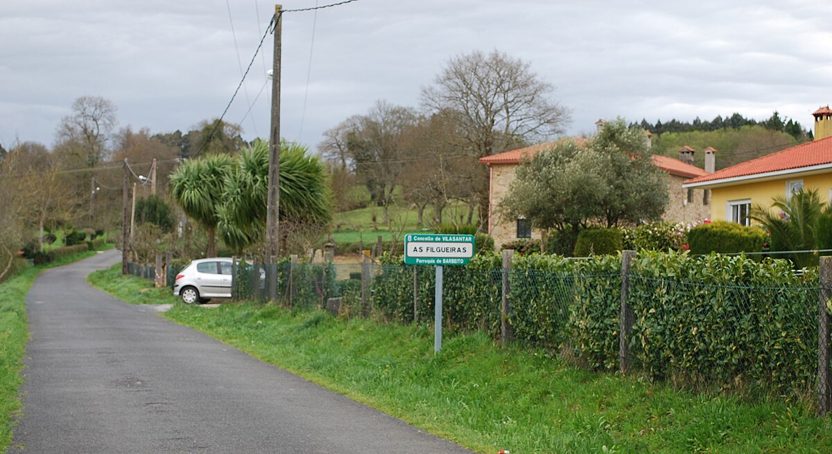
There is no single route. Exploration here means following secondary roads that connect the parishes of Vilasantar, such as Vilariño, Boimorto, or San Paio de Becés. These lanes are narrow, often lined with stone walls, and they curve with the topography.
Walking is possible, but there are few waymarked trails. A farm track may lead to a working dairy barn or end at a private gate. Using a car to cover distances between parishes, then stopping to walk into a village or along a lane, is the most effective method. Progress feels slow. A distance of five kilometres can take twenty minutes by car, not because of the length, but because of the bends and the need to yield to a tractor.
The Texture of the Place
The character of Vilasantar emerges in details, not monuments. Notice how the colour of the granite shifts from grey to silver when the sun breaks through after rain. Look for the carballeiras, the remnants of old oak groves, often found near churchyards. The chapel of Santa María in Vilasantar parish, an 18th-century building, sits quietly off the road, its scale meant for the local community, not for crowds.
The rhythm is agricultural. The sound is more likely to be a chainsaw cutting firewood or cows moving between fields than anything else. This dictates the daily schedule and the seasonal calendar.
Practical Considerations
Come here for the structure of a traditional Galician parish system, still visibly intact. Do not come expecting services laid out for tourism. You will find few bars or shops outside the main crossroads.
Wear shoes suitable for unpaved lanes and potentially damp grass. Having a detailed map or a reliable GPS is advisable, as signage is minimal. Cell phone reception can be patchy in the lower valleys.
A morning or afternoon is sufficient to grasp the pattern of the place. Drive from one parish church to another, stop to look at the architecture of the hórreos and the layout of the villages. The point is to see how these separate pieces form a coherent whole—a rural municipality that has changed shape slowly, and on its own terms.