Full Article
about Navia de Suarna
Hide article Read full article
A Valley That Became a Crossing
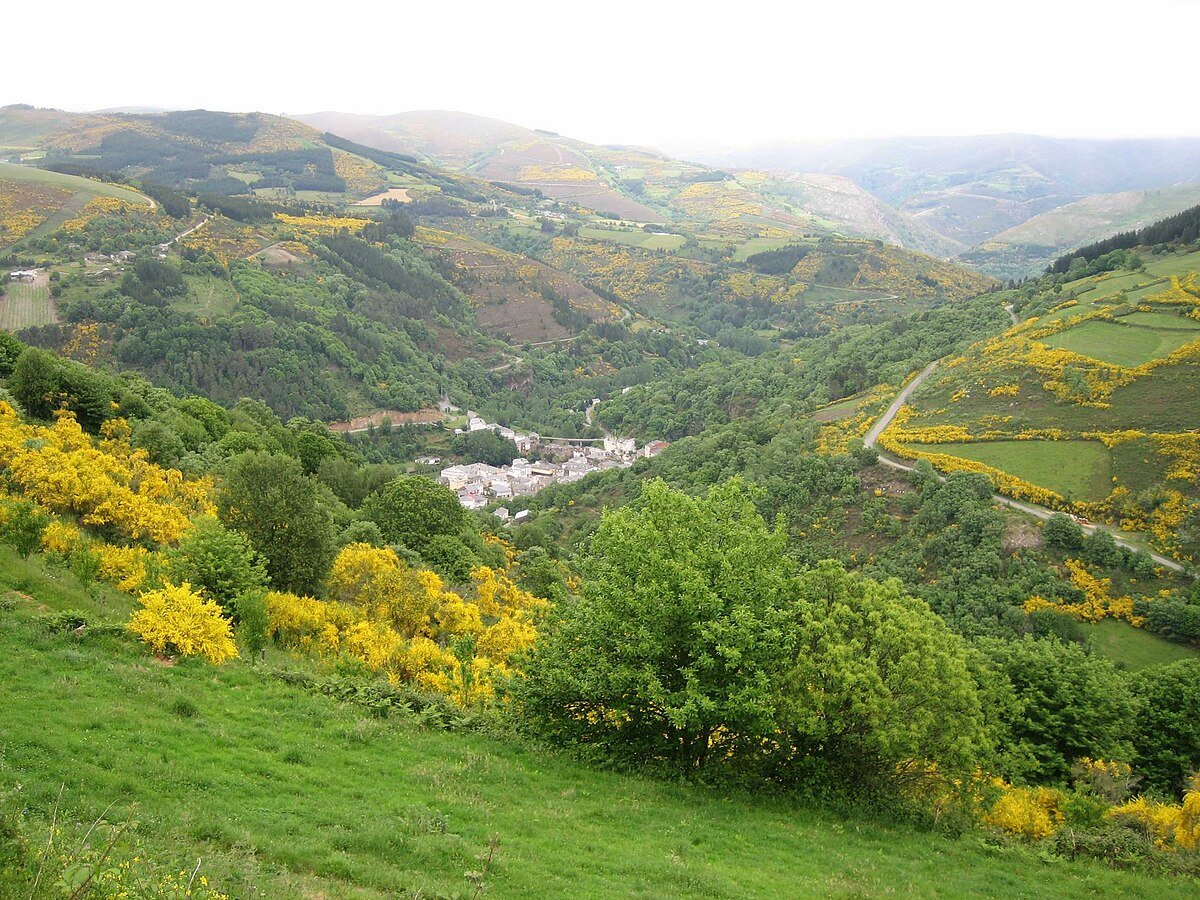
Tourism in Navia de Suarna begins with geography. In the far eastern corner of the province of Lugo, close to the borders with Asturias and León, the valley of the river Navia cuts a narrow passage through the mountains of Os Ancares. The village grew around this natural corridor. For centuries, it was one of the few places where the river could be crossed with relative ease.
That role as a crossing point explains its medieval origins. Navia de Suarna appears in documents from the Middle Ages as a place of territorial control. The bridge over the Navia, medieval in origin though much altered over time, and the remains of the old fortress both recall that defensive function. From here, movement between valleys and mountain routes could be watched and regulated.
Today the settlement remains small. Stone and slate houses cluster by the river, built to cope with long winters and persistent damp. The setting still feels defined by the same natural constraints that shaped its beginnings.
A Landscape Settled Long Before
Human presence in this area predates the present-day village. In several parts of the wider district, preroman castros have been found. These fortified hill settlements, typical of north-western Iberia before Roman rule, show that the mountains were already inhabited long before the medieval period. It is not surprising. River valleys offered pasture, water and a degree of natural protection.
Navia de Suarna took clearer shape later, when control of the territory passed into the hands of noble lineages linked to the Crown. The fortress that still stands beside the river is usually associated with that period. Its purpose was straightforward: secure the crossing and protect the small settlement that was developing nearby.
The parish church forms part of this historic structure. It is not a monumental building. It was probably built on the site of an earlier temple and, like many rural Galician churches, has been altered over time. Its presence marks the symbolic centre of the community, as was the case in most mountain villages.
Building for Climate and Work
Beyond these historic elements, what truly defines Navia de Suarna is its everyday architecture. Thick stone walls, slate roofs and wooden galleries appear both in the village centre and in the surrounding hamlets. These features were not chosen for appearance. They are practical responses to rain, occasional snow and constant humidity.
Hórreos and cabazos still stand among the houses. These raised granaries were used to store grain and protect it from damp and animals. Their forms vary depending on the area and the period in which they were built. Some remain in use.
The real map of the municipality lies in the small villages climbing the hillsides. Dispersed settlement is typical of Os Ancares. Each small cluster of houses was organised around cultivated plots, meadows and chestnut trees. The pattern reflects a way of life shaped by subsistence farming and livestock, closely tied to the land.
The Wider World of Os Ancares
Navia de Suarna forms part of a broader territory where adaptation to the environment has always been essential. Not far away, in the municipality of Cervantes, the pallozas of Piornedo are still preserved. These traditional houses with thick stone walls and large vegetal roofs show how people lived in these mountains well into the twentieth century.
This model of dwelling responded to a harsh climate and an economy based on livestock and self-sufficiency. Although most homes today have changed, the agricultural landscape continues to reflect that history.
Chestnut groves are particularly visible in autumn. They carry a historical weight. For centuries, chestnuts were a key part of the diet in these mountains. Their presence across the slopes is not decorative. It is the result of long-term cultivation and reliance on a crop that could withstand the local conditions.
Walking the Territory
The village centre can be explored quickly. The more revealing experience lies along the paths that connect hamlets and wooded areas. Many of these tracks follow old routes used for generations before modern roads were built.
The slopes are demanding. Distances that appear short on a map can take longer than expected. Moving through Os Ancares has always required time and effort.
Walkers in the surrounding area will see meadows enclosed by stone walls, small oak woods and streams descending towards the Navia. The landscape shifts noticeably with the seasons. In autumn, chestnut trees dominate. In spring, the valley turns intensely green.
This seasonal rhythm continues to define daily life. Even where agriculture is no longer the sole economic base, the visual character of the area remains closely linked to traditional land use.
Practical Context
Navia de Suarna is a small mountain municipality. Journeys take longer than they might seem on paper. Roads involve frequent bends and constant changes in gradient.
The village itself can be seen in a short visit. To understand the place more fully, it helps to move beyond the centre into nearby hamlets or to follow one of the valley paths. There, the way people have lived in this part of Os Ancares for centuries becomes clearer: a life organised around the river crossing, the slopes and the steady negotiation with climate and terrain.


