Full Article
about Negueira de Muñiz
Hide article Read full article
Between Lugo and Asturias
Negueira de Muñiz lies at the eastern edge of the mountains of Lugo, close to the border with Asturias, in the upper basin of the river Navia. Even by the standards of Os Ancares, this is a very small municipality. It has just over two hundred inhabitants, spread across villages separated by hills and valleys.
For centuries, communication with the rest of Galicia was difficult. Everyday ties such as markets, paths and family connections often looked towards the Asturian valley of the Navia rather than inland to Lugo. Geography shaped those relationships. The mountains created distance, while the river opened routes towards Asturias.
Isolation increased in the mid twentieth century with the construction of the Salime reservoir. When the dam closed, the course of the Navia changed and access routes had to be reorganised. Some land disappeared beneath the water and several traditional paths vanished. The reservoir still determines how people enter and leave the municipality. Roads are narrow and either skirt the water or cross mountain passes before dropping into the valley.
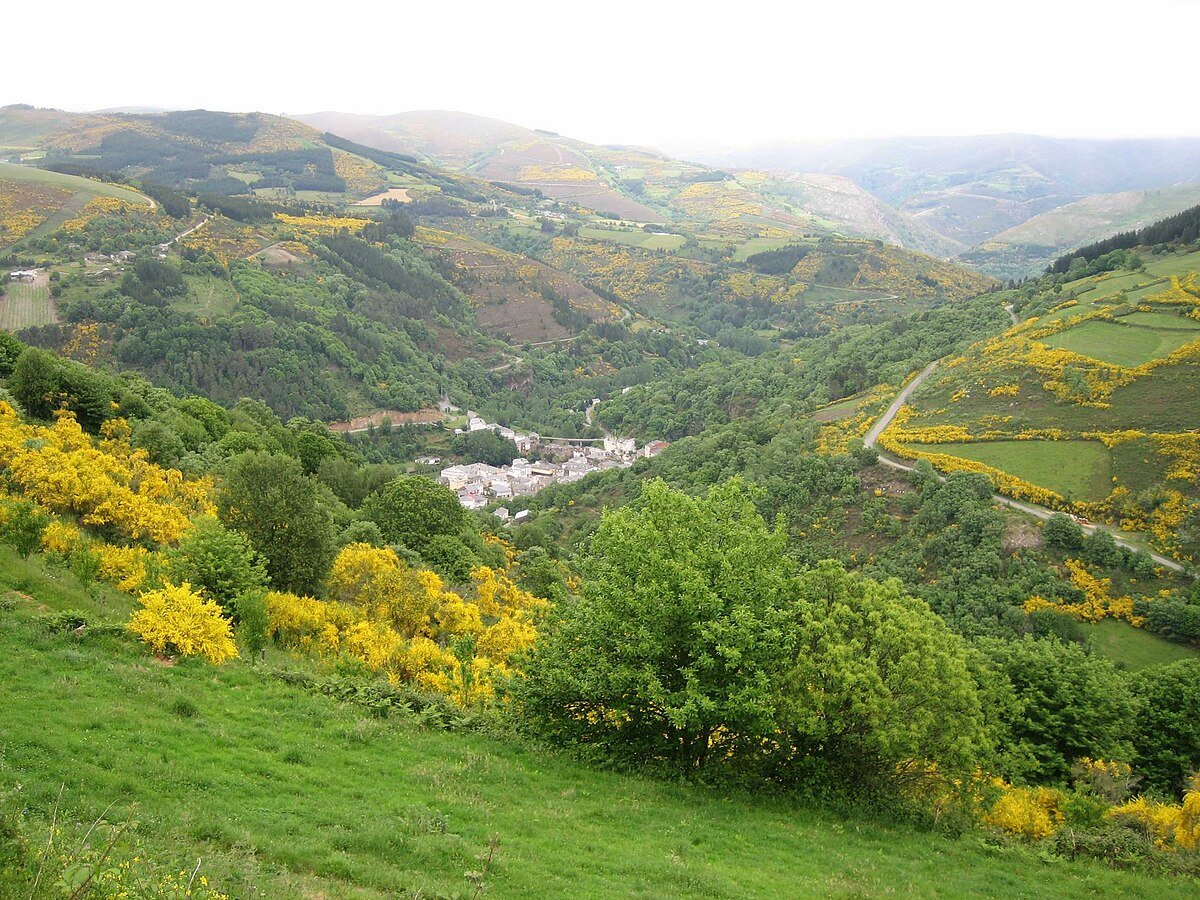
A Landscape Shaped by Water and Chestnut
The present landscape combines that recent history with much older patterns of settlement. Villages sit on sunny slopes, surrounded by small plots enclosed by stone walls. Chestnut and oak dominate the lower woodland. That is no coincidence. For centuries, the chestnut tree was a basic resource in this part of Galicia, valued both as food and for timber.
The rural architecture reflects practical responses to climate and terrain. Stone houses with slate roofs are common. Many have wooden galleries oriented towards the sun. Hórreos, traditional raised granaries typical of north-west Spain, stand on pillars to protect stored grain from damp. These structures are still in use. They are not preserved as museum pieces but remain part of a domestic economy that continues to depend on the surrounding hills and on small-scale livestock farming.
The parish church of Santa María follows a model widely found in the mountains of Lugo. The current building appears to be the result of successive alterations, probably on the site of an earlier structure. It is not monumental, yet it acts as a point of reference for the surrounding villages. Traditionally, churches like this marked the social calendar, hosting fairs, neighbourhood meetings and celebrations linked to the agricultural cycle.
A walk through places such as Castro, Ferreira or Muñiz reveals the scale of the territory. There is no compact centre. Each village consists of a handful of houses separated by meadows and kitchen gardens. The paths between them follow old routes, designed for travel on foot or with livestock long before modern roads were laid.
Understanding Negueira de Muñiz
Negueira de Muñiz is not organised around a single monument or a central square. Its interest lies in the way the mountain is inhabited. The scattered villages, the importance of chestnut trees in the landscape and the constant presence of the Navia explain much about the character of the area.
Its position on the map also matters. This corner of Lugo has historically existed between two spheres: Galicia and western Asturias. That overlap can be heard in the way people speak, seen in surnames and traced in the routes followed by old paths.
The municipality may appear close on a map, but reaching it takes time. The roads require slow driving and a steady sequence of bends. Part of that is due to the terrain, part to the reservoir itself, which altered traditional routes along the valley.
Because the villages are dispersed, services are not always available. It makes sense to arrive prepared for the day rather than assume that every settlement will have open shops or bars. Mobile phone coverage can fail in several parts of the municipality, so it is wise to have a clear idea of the route before setting out.
The Navia is not a stable river either. After periods of rain, the water level rises quickly and some access points to the bank become awkward. In drier spells, small river beaches and gravel areas appear where water usually covers the ground. The reservoir changes the outline of the valley according to the season.
If You Only Have Two Hours
A short visit can focus on one or two villages, paying attention to domestic architecture. Wooden galleries, hórreos and stone boundary walls reveal how rural life was organised in this part of Os Ancares.
It is also worth stopping at a point along the road where the Salime reservoir comes into view. From above, the transformation is clear. Water now fills what was once the valley of the Navia, while the villages remain on the slopes above. The scale of the reservoir helps explain the changes imposed on routes and farmland in the twentieth century.
When to Go
Spring usually brings water to the streams and fresh green hillsides. Autumn alters the landscape as chestnut and oak begin to lose their leaves. It is also the traditional season for gathering chestnuts and mushrooms in the nearby woods.
Summer temperatures tend to be moderate, though evenings cool down. Winter is harsher. Fog and rain can close in the landscape for days, and the roads become slower and more demanding.
Negueira de Muñiz does not offer a checklist of sights. Its appeal lies in understanding how people have adapted to a demanding terrain over centuries, first in relative isolation and later in the shadow of a reservoir that reshaped the valley. The mountains, the chestnut groves and the shifting line of the Navia provide the framework. The scattered villages give it human scale.