Full Article
about Ribas de Sil
Hide article Read full article
A valley shaped by the river
The municipality of Ribas de Sil takes its name and its character from the river. This is the southern part of Lugo province, within the comarca of Quiroga, where the Sil has carved a deep, steep-sided valley. Flat land is scarce here; every village and vineyard exists on a slope.
That basic fact of geography explains the layout. Settlements occupy the few gentler shelves. Roads coil tightly, following contours. The terraced vineyards, some dating to the medieval monasteries of the Ribeira Sacra, are a direct response to the incline. This is a landscape built by necessity.
The river’s importance is older than the vineyards. A few kilometres downstream, at Montefurado, you can still see the tunnel Roman engineers cut through a mountain to divert the Sil’s course. They were after the gold in its alluvial deposits. The scale of that operation gives you an idea of what the river represented centuries before it became known for wine.
Villages, churches and viewpoints
Ribas de Sil is not a town. It’s a collection of small villages—Arroxo, Leiroás, Pombeiro—scattered across the valley. The architecture is functional: local stone, slate roofs, hórreos raised on pillars to store grain. These are working villages, not preserved sets.
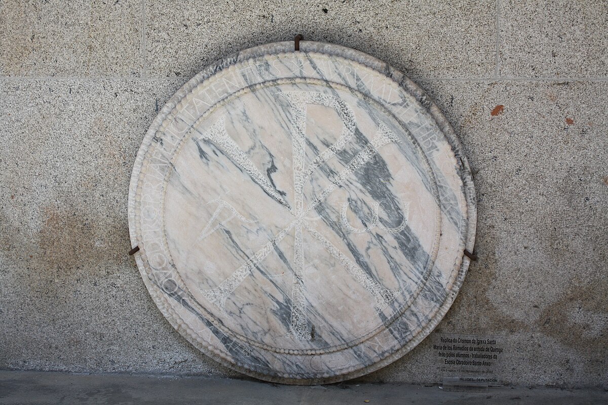
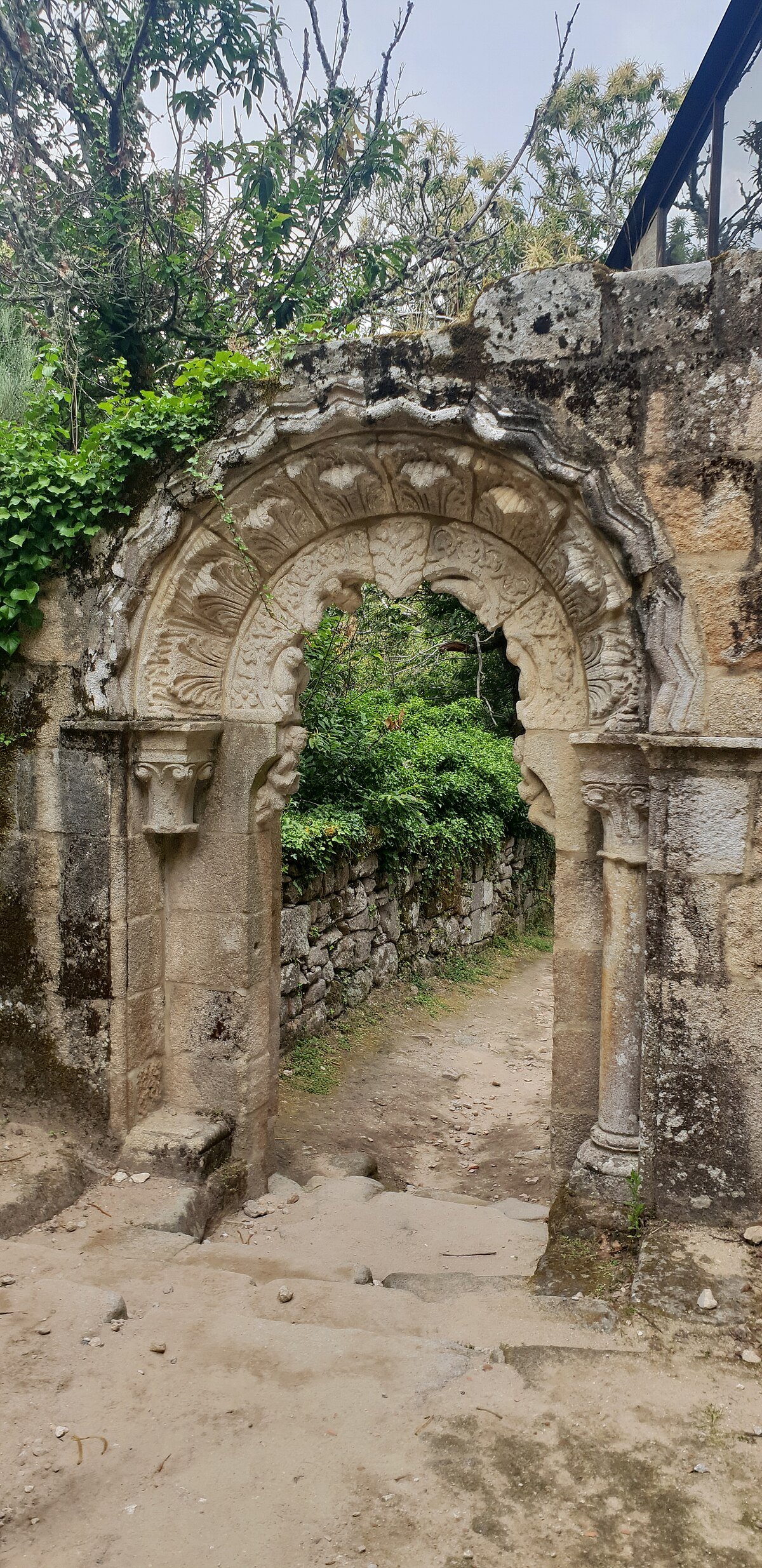
Several parish churches remain. The church of San Xoán de Ribas has a simple structure, likely built over an earlier foundation, which is typical for the area. Its significance is local, tied to the parish system that organised life here for generations. You’ll find smaller chapels too, often unmarked, still used for local festivals.
To understand the layout, you need a high point. From one, the logic becomes clear: the Sil is a tight corridor far below, with oaks and chestnuts on the less severe slopes, and vineyards wherever the sun hits. Herons are common along calmer stretches; if you’re quiet, you might see a kingfisher. The old paths that connect everything climb gradually, tracing lines between dry-stone walls and across streams.
Moving through the territory
The best way to see Ribas de Sil is to link its villages, either by car on the local roads or on foot using the traditional paths. Many of these paths are still used to access fields and chestnut groves. Conditions vary: some stretches are clear, others are steep or covered in loose stone.
It’s worth asking locally about current conditions before setting out. A path that’s straightforward in September can be slippery and muddy after the autumn rains.
This is active agricultural land. In autumn, the soutos—the chestnut groves—are busy with harvest. Viticulture continues under the Ribeira Sacra denomination. Some wineries in the area accept visitors, but not all do so regularly; checking ahead is necessary.
Practical realities of a steep landscape
There is no single historic centre to check off. Your visit will be measured in viewpoints reached and lanes walked. Do not trust map distances alone; two points that look close may be separated by a deep ravine, requiring a long descent and climb.
The slopes are earnest. Even a short walk demands footwear with proper grip, and carrying water is sensible. After rain, dirt tracks can become impractical with mud or shifting stones.
In the villages, parking requires consideration. Streets are narrow and often serve as access routes for tractors.
When to go
Spring and autumn show the valley at its most expressive. In spring, the chestnut groves bud and the hills turn green. Autumn brings colour to those same groves and vineyards, and with it, harvest activity.
Summer can be intensely hot in the middle of the day, especially on exposed slopes. During wet periods, it’s wiser to stick to the local roads and the more accessible viewpoints.
Getting there
The usual route is from Lugo, heading south towards Ponferrada on roads that follow the Sil valley. Ribas de Sil is inland Galicia; you arrive by road.
This municipality doesn’t offer a landmark. It offers a particular way of life, shaped by Roman engineering, medieval monks, and generations of working a steep river valley. You see it village by village, slope by slope, always with the sound of the river somewhere below.