Full Article
about Parada de Sil
Hide article Read full article
Roads That Slow You Down
Some roads are for quick errands. Others force you to ease off the accelerator whether you meant to or not. The roads around Parada de Sil, in Galicia, belong firmly to the second group. Tight bends, forest pressing in on either side, then suddenly an open window onto the canyon of the Sil. It feels a bit like wandering past shop windows with no intention of stopping, only to pause every few steps.
There is no single historic centre here, no main square lined with terraces. Parada de Sil works more like a scattering of small villages spread across a hillside. You move from one to the next, almost as if switching television channels, until another view of the Sil appears.
Three ideas help make sense of the place from the outset. First, the footpaths demand a slow pace. Second, many of the best views come after a stretch of walking. Third, the gradient rules everything. This is not a landscape for rushing. It is the sort of territory where you set out for a short stroll and return an hour later because the path kept descending.
Stone and Silence in the Forest
The monastery of Santa Cristina de Ribas de Sil sits deep in woodland, like an old house that no one ever thought to move. The approach alone changes your rhythm: a narrow road, trees closing in, and a growing sense of quiet.
The Romanesque church is usually dated to the 12th or 13th centuries, although the exact years blur between documents and later reconstructions. The stonework is restrained, with no excessive decoration. Everything seems in keeping with the landscape. It gives the impression that if you pushed the forest back just a little further, more hidden buildings might emerge.
A visit does not take long. People tend to spend more time looking around than reading information panels. The atmosphere recalls stepping into a village church during a walk and standing quietly for a few minutes before continuing on.
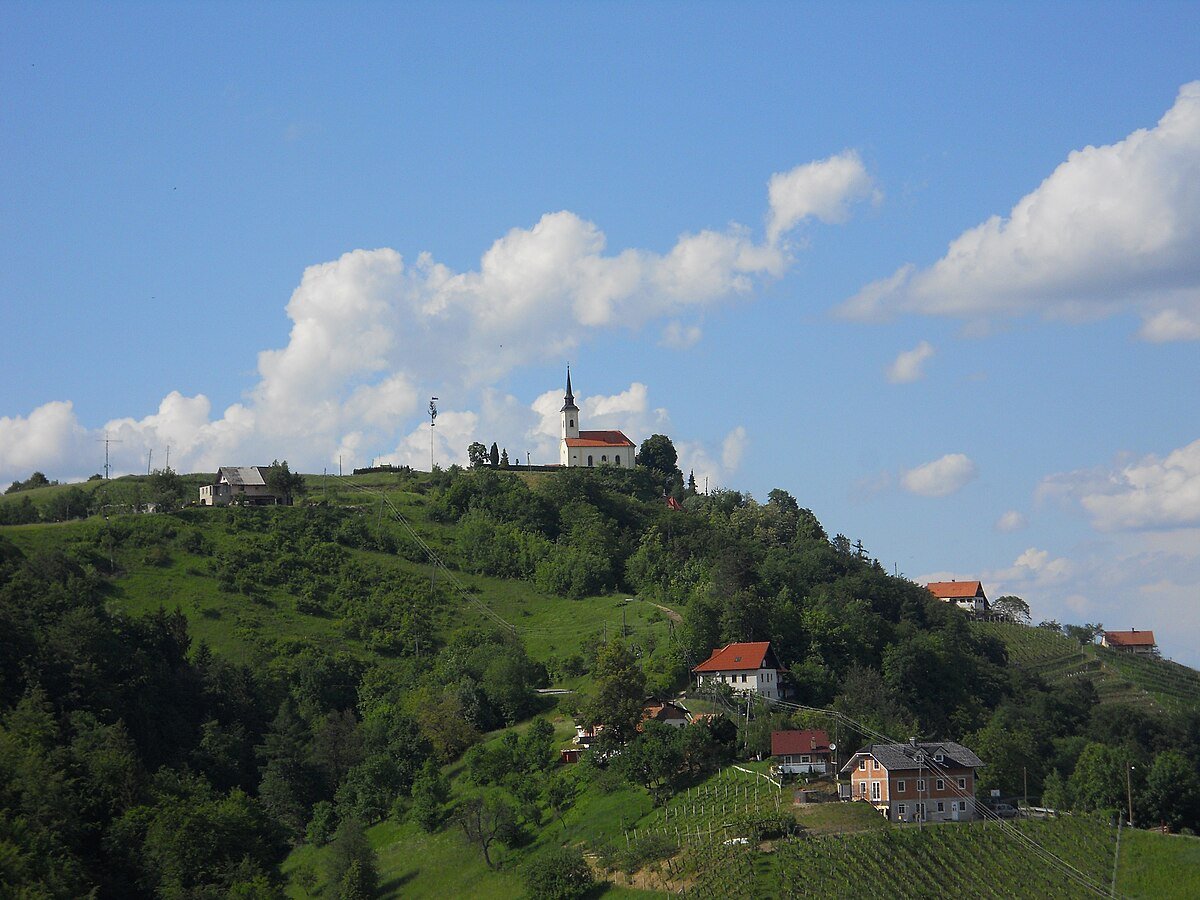
A few kilometres away, in the area of Barlaceira, stands the parish church of San Salvador. This is rural Romanesque without grand gestures: thick walls, small windows, and the solid feel of a building made to last centuries. From certain points in the valley it appears almost part of the terrain, as if it had grown directly out of the rock.
The viewpoints over the Sil canyon offer a different experience. Some are clearly signposted, others reveal themselves after a bend in the road or a short walk. Moving between them feels a little like opening drawers in an old house, each one holding a different view. At times the river lies far below. On other days it is half hidden by mist.
Scattered villages such as Cristosende, Abeleda and A Barrela help explain how life works here. Houses lean into the slope. Vegetable plots cling to the side of the road. Hórreos, the traditional raised Galician granaries, peek out from the greenery. A walk through these hamlets feels like stepping into a place where daily life runs at a very different tempo from the city.
Walking the Sil Canyons
Getting around Parada de Sil almost always involves walking at least a little. Paths cut through oak and chestnut woods, then cross stretches of scrubland where the ground smells of damp earth for much of the year.
Many trails descend from higher ground towards the river. The way down is usually manageable. The return journey is another matter. The climb back can resemble tackling a long staircase at the end of a tiring day, each step more noticeable than the last.
Some visitors explore the canyon from the water, typically by boat from jetties along the Sil. The change in perspective is striking. From below, the valley walls appear far more vertical than they seem from above.
The terraced vineyards offer yet another way to understand the landscape. These stone-built terraces occupy slopes that, seen up close, make you wonder why anyone would plant vines there at all. A walk beside those walls makes it clear why people here speak of heroic viticulture. The effort required is written into the hillside itself.
A Municipality Without a Centre
It is worth knowing this before arriving: Parada de Sil does not function as a compact town. There is no single main street with shops on either side, no central square where everything happens.
The municipality forms a mosaic of villages linked by narrow, winding roads. The car plays an important role. Distances look short on the map, yet the slopes force frequent detours.
In return, unexpected moments appear. You park at a crossroads, walk five minutes, and find yourself alone in front of the canyon. The feeling resembles stepping outside for a mundane task and lingering because the night sky happens to be unusually clear.
Rain changes the landscape considerably. Mist drops lower, the greens darken, and long views sometimes disappear altogether. The result is not worse, simply more enclosed and distinctly Atlantic in character.
If Time Is Short
With only an hour or two, it makes sense to head for a viewpoint near A Barrela or the area around Cristosende. The canyon reveals itself abruptly and offers an immediate sense of the territory.
Afterwards, it is worth spending a little time walking through a nearby village. There is no need to search for a particular landmark. Follow the path, look at the hórreos, notice how the houses settle into the slope. Parada de Sil does not require a checklist. It asks for unhurried steps, attention to the terrain, and a willingness to let the road decide the pace.