Full Article
about Carballedo
Hide article Read full article
A Territory Without a Centre
To understand Carballedo, you start with the map. This municipality in southern Lugo, within the Terra de Lemos, occupies a transitional space. It sits between the inland plains and the slopes that descend towards the Ribeira Sacra’s canyons. There is no main town. The population of around two thousand people is distributed across more than forty parishes and small villages, separated by low hills, streams, and fields enclosed by muros de pedra.
This dispersion is not accidental; it is the structure. The area developed as a network of small, self-sufficient communities, a pattern of rural settlement that dates back centuries. Each parish functioned as a basic unit of daily life, long before the modern municipality was drawn. The medieval history here is tied to monastic networks and minor lordships, their influence visible in the parish churches that still anchor the landscape. These churches were often rebuilt or altered over generations, their scale reflecting the resources of each local community. As a result, the heritage here is not collected in a single monument but scattered, requiring you to move between points to see it.
Fragments of Heritage
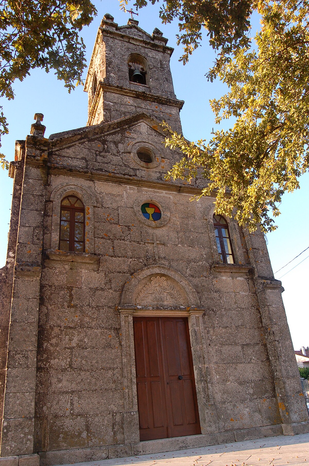
The parish churches are the most consistent landmarks. You see masonry from different periods—Romanesque foundations, later bell towers, added porches. The cemeteries beside them are often shaded by old oaks or chestnut trees, species traditionally planted in these spaces. If the church door is open, step inside. The interiors are usually simple, with altarpieces and carvings made by local artisans. They feel more like a record of community life than a curated museum.
At crossroads, you’ll find cruceiros. These stone crosses functioned as both religious markers and territorial signs, denoting parish boundaries or the entrance to sacred ground. Their designs vary: some are plain, others have more detailed carving on the base. They weren’t erected in a single campaign but over time, as communities could afford them.
Other structures speak to a different social layer. Pazos and old rectoral houses, often still privately owned, stand with stone coats of arms on their façades. They remind you of the manorial system that once overlay these farming communities.
Then there is the utilitarian heritage: grain mills by streams, hórreos on their stone pégares, sections of old paved paths. They point to an economy historically based on cereals, chestnuts, and woodland. You won’t find explanatory plaques; noticing them depends on your own observation.
Moving Through the Landscape
The way to see Carballedo is to drive or walk between its parishes. The local roads are narrow and winding, connecting hamlets where the scenery shifts slowly. Chestnut groves—soutos—give way to enclosed meadows and patches of scrub. Some of the old paths remain in use, leading to fields or communal woods.
As you move south and west, the terrain changes. Vineyards begin to appear on slopes, a sign of proximity to the Ribeira Sacra. The wine tradition here is old, historically linked to monasteries and small-scale growers. Activity remains local; don’t expect large, signposted bodegas.
Autumn alters the palette and the rhythm. The soutos are full of chestnuts, and mushrooms appear in the woods. Foraging is common, but it requires knowing the land and respecting its ownership.
Practical Notes for Visiting
You will need a car. Public transport within the municipality is limited and not designed for exploratory travel. Distances between parishes are often several kilometres, and journeys take longer than the map suggests due to the road conditions.
Wear sturdy, waterproof footwear, especially outside summer. Dirt tracks and paths can be muddy, and fog is frequent in the valleys, sometimes reducing visibility dramatically.
Common Misunderstandings
Some arrive looking for a consolidated historic centre with a main plaza and cafes. Carballedo is not that. Its logic is parochial and agricultural. The interest lies in reading that logic in the landscape—in the placement of a church, the line of a stone wall, the route of a sunken path. Adjust your pace accordingly; what seems like a short trip can become a slow traverse through a territory that still operates on its own terms.


