Full Article
about Nigrán
Hide article Read full article
A valley entrance shaped by water
Tourism in Nigrán often begins in A Ramallosa, where the river Miñor opens into the ría de Vigo. This meeting point between river and estuary has long shaped the area’s role. A medieval bridge still stands here, and for centuries it marked the natural crossing between the Val Miñor and the route towards Vigo. Its presence explains the layout of the place quite clearly: rather than just a coastal town, Nigrán functioned as a gateway to the entire valley.
That sense of passage remains visible today. Roads and settlements gather around A Ramallosa, reinforcing its role as a link between different parts of the region. Even now, it feels like a point of transition rather than a destination in isolation.
Where the sea moves inland
The municipality stretches from the ría up to the slopes of Monte Galiñeiro, and that shift in elevation is noticeable on the ground. The parishes of San Fiz, A Ramallosa, Panxón, Chandebrito, Camos, Priegue and Parada form a gradual transition between the open coastline and the higher inland areas. Near the sea, residential developments and second homes are more common. Further uphill, older houses appear, along with enclosed plots marked by stone walls and quieter routes that connect to Vigo by secondary roads.
The ría here does not feel like open sea. In Panxón, the water enters gently and takes on the character of an estuary, which defines much of the Galician coastline. Offshore, the bateas used for mussel farming sit in rows. These wooden platforms form small floating grids when seen from land. Early in the day, it is common to hear working boats moving between them, a reminder that this is still an active maritime environment.
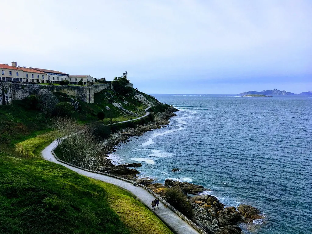
Monteferro and the view across the ría
The promontory of Monteferro rises above the southern entrance to the ría de Vigo. From its summit, the strategic value of this position becomes clear. The view takes in the outline of the Islas Cíes and a wide stretch of the ría’s mouth.
Remains of 20th-century military installations can still be found at the top. These concrete structures were built to monitor the coast and are now partly hidden by vegetation. They are easy to overlook unless you know where to look. Today, the site works mainly as a viewpoint. On clear days, the profile of the Cíes stands out sharply, while inland the urban continuity linking Nigrán with Vigo becomes visible.
Lower down, in Panxón, one of the municipality’s most distinctive buildings comes into view: the Templo Votivo do Mar. Built in the first half of the 20th century and designed by the architect Antonio Palacios, it combines different architectural references. Granite gives it a monumental feel, while concrete elements introduce a more modern tone. Its imagery is closely tied to the seafaring world. Local tradition holds that the temple was built as a collective promise after several severe storms along the coast.
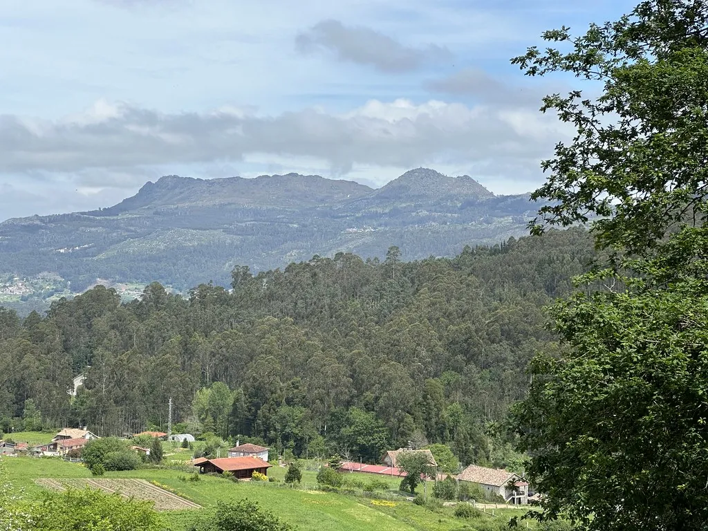
Chandebrito and traces of recent history
Further inland, the landscape changes again. Chandebrito faces towards Monte Galiñeiro and retains a more rural character than the coastal areas. The hills here have been affected by fires at different times, as has much of southern Galicia, and that impact is still visible on some slopes.
In the village, a sculpture made from charred wood taken from one of these fires has been installed. The piece uses blackened trunks with very little alteration, leaving the texture of the material clearly exposed. It works as a reminder of how much the Galician landscape is shaped by cycles of destruction and recovery.
Chandebrito also has a small monument dedicated to the group Milladoiro, which was linked in its early years to the Val Miñor area. The work is made up of granite blocks arranged in a spiral around a traditional instrument. It is not a large monument, but it fits naturally in a place where folk music continues to be present in local festivals and cultural centres.
Between dunes and ancient rock
Playa de América forms one of the longest stretches of sand in this part of the ría. The name became widely used in the mid-20th century, when the coastline began to attract summer visitors from other regions. Comparisons with larger Atlantic beaches, more open and extensive than the small coves often found in Galicia, eventually fixed the name.
The shape of the beach is not constant. Winter storms shift the الرمال and move the dunes, making periodic regeneration work necessary to maintain its profile. This ongoing change is part of the character of the shoreline rather than an exception.
From this beach, it is possible to walk towards Patos along the coastal edge. The route follows a low cliff and leads to rocky surfaces where prehistoric petroglifos can be found. These carvings, made thousands of years ago, include spirals and concentric circles etched into the stone. They are not always easy to spot at first glance. Often, the low light of late afternoon helps to bring out the خطوط carved into the rock.
Finding your way around
Panxón and Playa América concentrate much of the activity during the summer months, while A Ramallosa works as a small hub connecting Nigrán with Gondomar and Baiona. Distances within the municipality are not large, but the dispersed layout of the parishes makes travelling by car or bicycle a practical option.
A cycle lane runs through the Val Miñor, offering a simple way to move between different نقاط of the area while following the natural line of the valley.