Full Article
about Torrelodones
Prestigious residential town dominated by its Moorish watchtower beside the A-6.
Hide article Read full article
Torrelodones is reached quickly from Madrid. The approach along the M‑503 sets the tone at first: shopping centres, traffic, the feel of a commuter town. Then the road climbs and the landscape shifts. The watchtower appears above the Guadarrama valley, and that single structure explains most of what this place is.
A direct way to get your bearings
Parking near avenida de la Constitución saves time. Spaces are usually available there, and it avoids navigating the narrow streets of the old centre, which are not suited to large cars.
The walk up to the Atalaya takes about twenty minutes. The route begins on concrete before turning into a dirt path. Morning is the best moment for the climb. At midday the sun is harsh, especially in summer, and there is little shade on the way up.
The tower does not follow a clear opening schedule. Sometimes it is accessible, sometimes it is closed, depending on the state of the entrance. When entry is not possible, the exterior still justifies the climb. From the slope, the encinar spreads out below, the La Coruña motorway cuts through the landscape, and on clear days the outline of Madrid appears in the distance.
A town of contrasts
The historic centre is small and quick to cover. Half an hour is enough, perhaps a little more with stops along the way.
The iglesia de la Asunción stands at the centre. It is simple in form, without elaborate decoration. The bell tower looks older than it actually is, which creates a slight sense of mismatch between appearance and history. Nearby sits the fuente del Caño, once used as a communal washhouse where laundry was done for centuries.
Higher up, on the top of the hill, stands Canto del Pico. This early 20th-century mansion was built using pieces taken from other historic buildings. It has been closed for years and is usually seen only from the outside, its silhouette visible from various points around the area.
Torrelodones does not match the idea of a traditional mountain village. It is a mix of residential developments, roads and stretches of open countryside. There are long-established bars where dishes like callos or cocido appear at the weekend, but food is not the main reason to come here.
The story behind the tower
The Atalaya dates back to the Andalusí period. It formed part of a network of watchtowers that monitored routes towards the Sierra. From this point, the valley could be observed and signals sent to other towers across the region.
After the Christian advance, the tower continued to serve as a lookout. Much later, during the Spanish Civil War, the hill took on a military role again as an observation point. Marks remain on the stone, though their exact origin is not always clear.
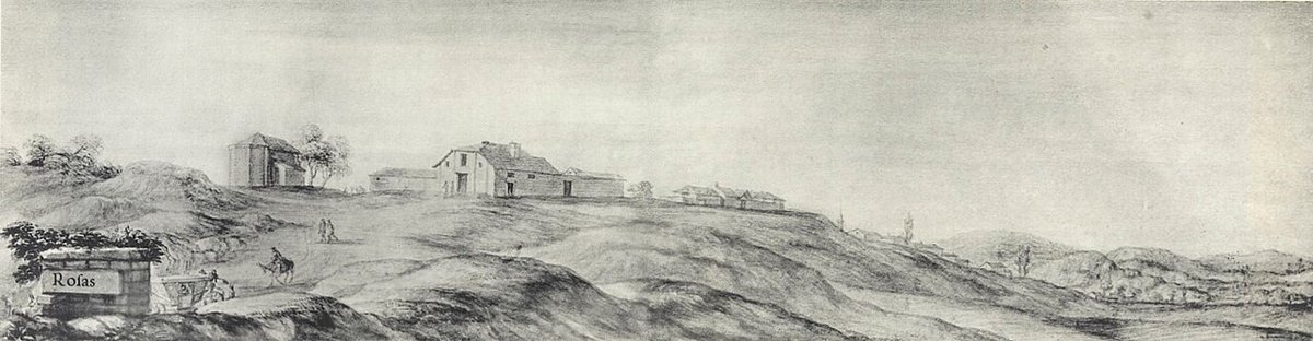
The name Torrelodones is linked to the almez tree, once common in the area. Today only a few remain. Medieval documents record variations of the name, including forms similar to “Torre de Lodones”, which reflect that earlier landscape.
Walking it off on granite and oak
The most common walk is the route up to the Atalaya. The round trip is around three kilometres. It presents no technical difficulty, although the ground is uneven and stony in sections.
Several paths extend around the municipality, crossing areas of encinar and granite outcrops. These routes are widely used for walking and mountain biking. The terrain does not involve major elevation changes, yet footwear with a firm sole makes a noticeable difference on the rocky surface.
Tracks also lead down towards the Guadarrama valley from the edges of the urban area. These are steady routes suited to a slower pace, provided there is water and time to move without rushing.
A place best taken in stride
Torrelodones works best as a short stop rather than a full-day destination. The climb to the Atalaya, a brief walk through the centre, then onward towards the Sierra is a rhythm that fits the place.
Weekdays offer a quieter experience. At weekends, many people arrive from Madrid and parking becomes more difficult than it first appears.
Good footwear matters more than expected. The ground is loose granite, and it puts strain on ankles despite how manageable it looks on a map.