Full Article
about Cervera de Buitrago
Riverside village on the El Atazar reservoir; known for its sailing club and water views.
Hide article Read full article
A slower rhythm in the Sierra Norte
Some places feel like turning the volume down after a long day. The noise fades, things settle, and you start to notice the quiet. Tourism in Cervera de Buitrago has something of that effect. It sits just over an hour from Madrid, yet the change in pace arrives quickly. Less traffic, fewer distractions, and streets that seem made for walking without checking the time.
Cervera is small, very small. With around 165 residents, the village folds in on itself like a cluster of houses gathered against the wind. The layout does not follow a clear plan. Streets rise and dip in a way that feels organic, as if each corner appeared wherever there was space at the time. It can bring to mind the model villages some people built as children, compact, uneven, and held together by its own internal logic.
The church at the centre
At the heart of the village stands the church of Nuestra Señora de la Asunción. Parts of it are usually dated to around the 15th century, with later additions layered over time. It is not the kind of landmark you spot from far away. Instead, it appears naturally as you walk through the streets.
The building has the solid feel typical of churches in mountainous areas, with thick walls that suggest long, cold winters. Walking around it gives the impression of looking at different periods at once. Each change and extension has left a visible mark, like a wall that quietly records its own history.
Houses, slopes and sudden views
The houses follow traditional patterns from this part of the region. Stone is common, with some adobe in certain walls, and sloping roofs covered in tiles. In summer, wooden balconies often hold a few plants. Nothing excessive, just small touches that suggest daily life rather than decoration for show.
Walking through the village comes with a small surprise built in. Some streets seem to end abruptly, only to open onto views of the El Atazar reservoir. It feels similar to turning a corner in a city and suddenly seeing something expansive in the distance. Here, that something is water.
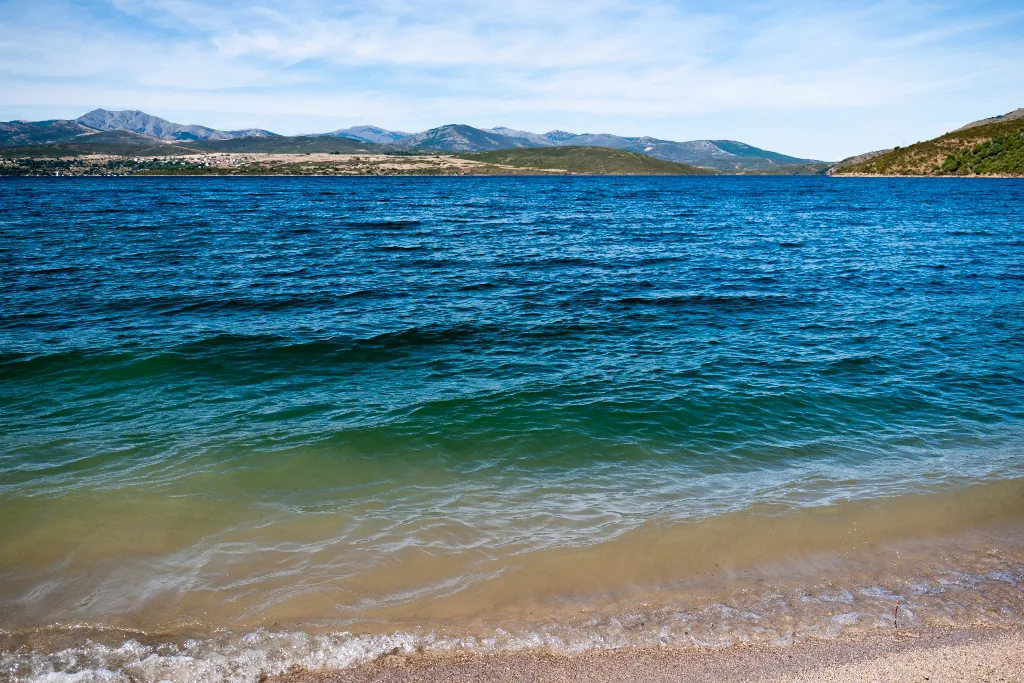
El Atazar: close, but not quite
The reservoir is clearly visible from several points in Cervera, yet reaching the shore on foot is not always as straightforward as it looks. It creates the same illusion as seeing a beach from above and assuming it is just a short walk away, only to realise the route takes longer than expected.
Even so, the nearby tracks and paths offer wide views of the water as it curves between low hills. On clear days, the blue of the reservoir contrasts with the darker greens of holm oaks and pines. The landscape feels open and unforced, the kind of setting that encourages walking without needing a fixed plan.
Walking without a set route
Several rural tracks begin around the village. They are simple dirt paths rather than technical trails. Occasionally a car passes slowly, or a cyclist appears, but the overall feeling is unhurried.
These are easy routes to follow. You walk for a while, take in the surroundings, and turn back when it feels right. The terrain combines oak, holm oak and pine. In autumn, the colours shift noticeably. In winter, the scene becomes more restrained, like an image with fewer tones but stronger contrasts.
A small stop within the Sierra Norte
Cervera de Buitrago is not a full-day destination. It works better as a calm stop within the Sierra Norte of Madrid, a mountainous area to the north of the capital. It is the sort of place where a short visit stretches into a longer walk without much planning.
Nearby are places with more activity, such as Buitrago del Lozoya or the Lozoya Valley. Many visitors combine several stops in a single day. Cervera fits easily into that rhythm. It is somewhere to get out of the car, walk for a while, and end up staying longer than expected because the setting invites it.
A short visit, taken slowly
What suits Cervera best is simplicity. Park, walk without a defined route, and stop at the points where the reservoir comes into view. Around half an hour is enough to cover the centre. An hour if you linger.
There are no grand monuments or busy streets competing for attention. The appeal lies elsewhere. It feels closer to a quiet conversation that continues because there is no rush to leave. That lack of urgency is what makes it worth the stop.