Full Article
about Chapinería
Mountain village ringed by holm-oak groves; it has a historic palace and a protected natural area.
Hide article Read full article
A village shaped by stone
Tourism in Chapinería begins with the material that defines it. Granite, known locally as berroqueño, appears in walls, boundary fences and much of the paving underfoot. It is the same stone quarried for centuries in the nearby mountains, and the same used in major works across the Community of Madrid, including the monastery of El Escorial. There is no courtly grandeur here, yet the constant presence of this hard stone gives the village centre its character.
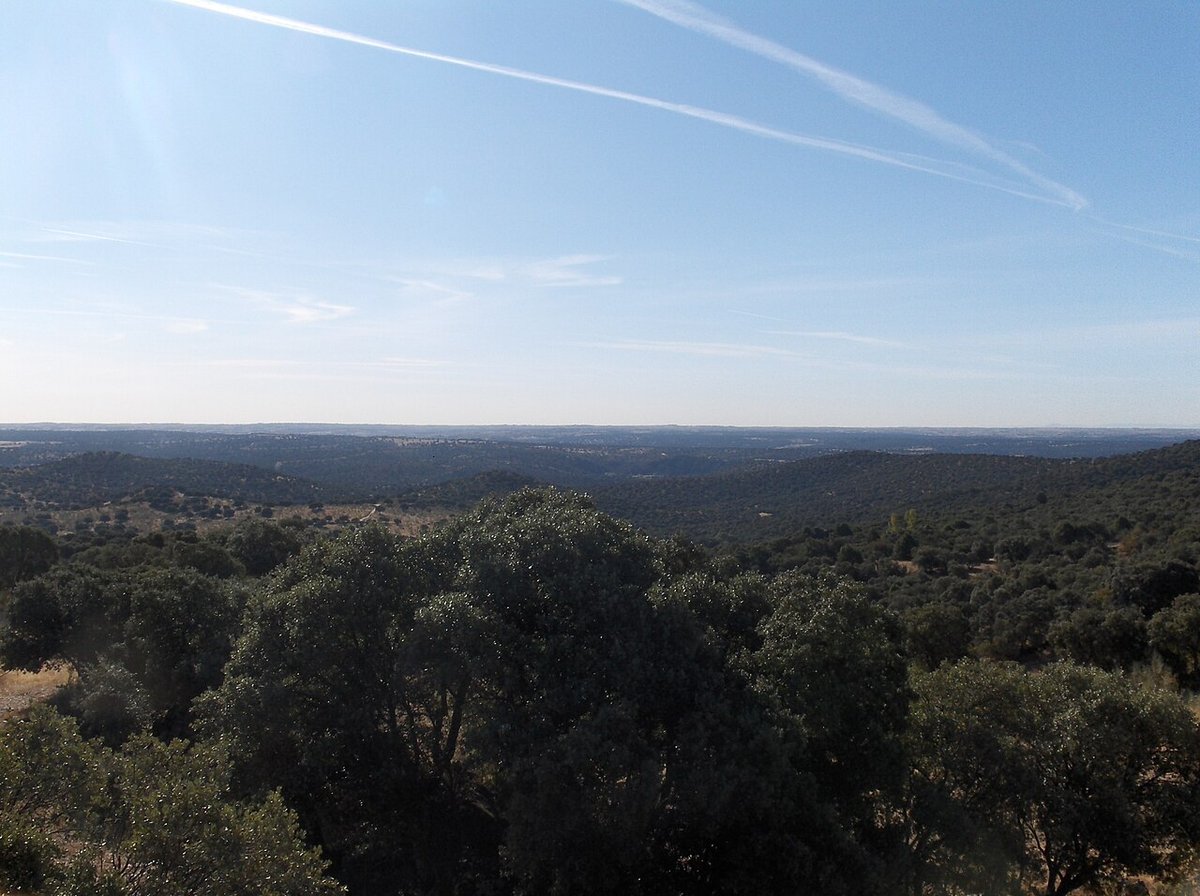
Chapinería lies in the Sierra Oeste, in a transitional area between the mountains and the Alberche countryside. That setting explains much of its past. The landscape is a mix of dehesas, grazing land with scattered trees, livestock routes and small settlements that grew along internal routes linking one place to another.
Granite and the passing of time
The origins of the village are usually placed in the Late Middle Ages, when these territories began to organise into stable settlements after centuries of seasonal livestock use. Before that, the area functioned largely as a corridor for transhumant herds moving across the region.
There are several interpretations of the name Chapinería. One of the most commonly repeated links it to the chapín, a type of elevated shoe designed to keep feet above mud. It is difficult to know how accurate that is, yet it hints at the terrain itself: wet ground in winter and paths that were far from firm for much of the year.
At the highest point of the village stands the church of Nuestra Señora de la Concepción. Its main structure dates from the 16th century, a time when many churches in the area were expanded or rebuilt. The architecture is restrained, close to the Herrerian style that spread during the reign of Philip II. The interior was altered later, and the main altarpiece reflects later Baroque tastes. From around the church, the logic of the settlement becomes clear: visual control over both the cluster of houses and the routes that connected the area with San Martín de Valdeiglesias.
Names and traces of the past
One of the figures associated with Chapinería is Eloy Gonzalo, later known as the “héroe de Cascorro”. Before his involvement in the war in Cuba, he served as a young guardia civil stationed in the village. The episode is remembered locally without grand gestures, as part of the town’s history rather than an epic tale.
Another building that draws attention is the Palacio de la Sagra. It is linked to hunting activities carried out by the nobility in the area, and was probably constructed in the early modern period. Today it houses a small ethnographic museum. Inside are agricultural tools, household utensils and objects connected to traditional trades. They are not exceptional pieces, but they help explain how people worked and lived in this part of the Sierra Oeste well into the 20th century.
Shelter, paths and devotion
Along the tracks that surround Chapinería, small structures linked to earlier forms of travel can still be found. One of the best known is the refuge called El Bombo, built beside the old road towards San Martín de Valdeiglesias. It provided shelter for muleteers, shepherds and travellers when journeys were made on foot or horseback. The structure is simple: thick masonry walls, a sloping roof and a hearth inside.
Closer to the village centre, a stone Vía Crucis climbs towards the ermita del Santo Ángel de la Guarda. The crosses are carved in granite and mark the fourteen traditional stations. The hermitage itself is modest, built directly onto the granite slabs of the terrain. In the second half of the 20th century, it was dismantled and moved a few metres uphill due to road works.
When the village slows down
Semana Santa in Chapinería has a distinctly local tone. The brotherhood known as the Cofradía de los Cuatro Pasos brings together residents who carry religious images through the streets of the old centre. The atmosphere remains restrained and close to everyday life.
Beyond the built area, a well-preserved dehesa of holm oaks and oaks stretches around the village. From the Centro de Educación Ambiental El Águila, several marked routes begin and cross these landscapes. Some of them pass seasonal ponds and old springs that served for everyday water supply over decades.
These are not routes designed for dramatic mountain scenery. They are quiet walks that make it easier to understand how the village related to its immediate surroundings: grazing land, small cultivated plots and areas used for firewood.
Getting there and moving around
Chapinería is connected to Madrid by the M‑501 road, heading towards San Martín de Valdeiglesias. The journey from the capital takes about an hour by car, depending on traffic. There are also interurban bus lines linking the village with the Príncipe Pío transport hub in Madrid.
Once there, the village centre can be explored easily on foot. The church, the Palacio de la Sagra museum, the hermitage and the Vía Crucis all sit within a short distance of each other. Beyond these points, the interest lies in paying attention to the details: the granite underfoot, the layout of the streets and the traces of older ways of moving through the landscape.

