Full Article
about San Pedro del Pinatar
Hide article Read full article
Where the day begins in mud and light
At half past eight in the morning, the mud of the Mar Menor still holds the cool of dawn. Feet need to sink in with purpose, down to the ankles, and then wait as the dense, cold texture grips like a damp hand. From the bathing area of Lo Pagán, the salt flats gleam in the distance with a white brightness that strains the eyes. A flamingo lifts into the air and drops a feather, which drifts for a moment before settling on the dark water.
San Pedro del Pinatar reveals itself slowly in these early hours. The landscape feels suspended between elements, between what is solid and what shifts. Mud, salt and shallow water shape the rhythm of the place, and even the smallest movement seems to leave a trace.
A landscape soaked in salt
The regional park occupies what were once lagoons. Salt is still harvested here in a traditional way, relying on sun and wind to do the work. A dirt track runs along the ponds, crunching underfoot, while the air carries the sharp taste of iodine, dried algae and something older that is harder to name.
From the observatory at Las Amoladeras, groups of flamingos can be seen spending the winter months here. At times their feathers are streaked with mud, as if they had been handled with unwashed hands. They stand in clusters, still or slowly shifting, blending into the pale reflections of the water.
In the middle of this setting stands the Molino de Quintín. It is one of the few remaining windmills that once helped move water through the salt flats. Its wooden sails no longer turn, yet when the Levante wind blows, it feels as though they might start again at any moment. Inside, the scent is thick with old grease and sun-warmed stone. From its base, the Mar Menor stretches out like a slab of blue-green, so calm that it mirrors the clouds in a fractured reflection.
Two seas, one place
San Pedro del Pinatar sits between two very different seas. To the south lies the Mar Menor, a saltwater lagoon with barely any waves, where in August the temperature can feel almost like a thermal bath. To the north, the Mediterranean opens out, with sandy seabeds that shift with the currents.
Between the two runs a narrow strip of dunes. Palmitos grow here, and after storms the shore is scattered with broken shells and pieces of wood bleached by salt. It is a changing line, shaped constantly by wind and water.
La Llana beach transforms each winter. The wind moves the dunes and the sea pushes further inland. At times, the stretch of sand narrows so much that temporary lagoons form. This is a place of transition, where coastal vegetation withstands the salt-laden air. The area is protected, and the paths are marked to avoid damaging the dune ecosystem. Walking here means keeping to the trodden الرمل or the wooden walkways that guide the way across this shifting ground.
Kitchens shaped by the wind
When the Levante wind strengthens, kitchens across the town fill with steam. One dish in particular defines the local table: the caldero of the Mar Menor. It depends on rock fish such as sargo, mújol or gallineta. The cooking happens in an iron pot that may have passed through several generations, with ñora pepper adding depth and time doing the rest, allowing the rice to absorb the flavour of the sea.
In the fish market at Lo Pagán, boats return towards evening. Blue plastic crates fill with cuttlefish, sea bream and grey mullet. Nearby, in the salting houses, hands move quickly as fish are covered with coarse salt and packed into wooden barrels. The smell is strong and lingering, a mix of open sea and preservation that clings to the skin.
This connection between sea, salt and food runs through everyday life. It is not presented as something special, but as something continuous, shaped by weather and habit.
Notes for the journey
September brings a gentler pace. The heat eases, flamingos can be watched without hurry, and the town settles into a quieter rhythm. The second half of July, by contrast, draws large crowds due to the processions of the Virgen del Carmen, a religious celebration that fills the streets and makes access to the centre more difficult.
In winter, visiting the park requires closed footwear. Rain can turn the dirt paths into stretches of clay-like mud. It is during these colder months that the sky often turns a heavy grey, making the pink of the flamingos stand out more vividly against the water.
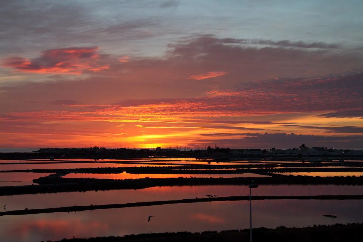
From the area of Punta de Algas, the dual nature of this place becomes clear. Calm water faces rougher sea, white salt flats sit alongside dunes. As evening approaches, the sun drops behind the mountains, casting an orange glow over the windmill sails and the curved backs of birds resting in the mud, their beaks tucked beneath their wings.

