Full Article
about Ablitas
Ribera town known for its medieval castle and olive-oil production; set on a plain overlooking Moncayo.
Hide article Read full article
Where Navarra Meets Aragón
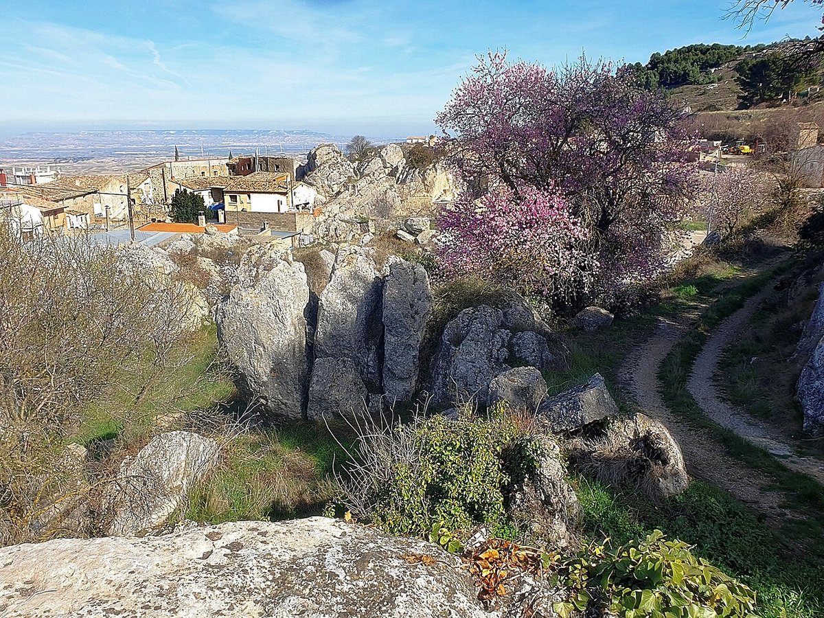
Ablitas sits at the southern edge of Navarra, where the Ribera begins to look towards Aragón. The setting defines it from the outset: open farmland, frequent wind, and the valley of the Queiles shaping a natural corridor between Tudela and Tarazona. That passage has long channelled movement through the area, and it goes a long way towards explaining what the town is today.
For centuries, this was a place people passed through rather than settled in isolation. Traces of that steady flow still appear around the edge of the urban area. The landscape is not just a backdrop but a record, with routes and fields that hint at older patterns of travel and use.
A Road That Still Speaks
On the outskirts, a stretch of Roman road survives. It is not extensive, yet it offers a clear sense of how the route once functioned, linking settlements across the valley. The paving stones remain aligned, and the edges of the الطريق can still be picked out without much effort.
This section connects with the Roman site of El Villar. Excavations there uncovered the remains of an agricultural villa and a sizeable mosaic found in recent digs. Not far away, a Visigothic necropolis was also documented. Together, these finds suggest continuity rather than interruption: first Roman rural estates, then later communities that continued to use the same land in the centuries that followed.
Walking this fragment of road places Ablitas within a much older map. Before it was a defined town, this was already a crossing point shaped by movement between places.
The Castle Tower on the Skyline
The most recognisable feature of Ablitas is the tower of its former castle. Its origins are usually placed in the medieval period, probably around the 12th century, although the structure has undergone many changes since then.
Rather than a large frontier fortress, it likely served as a point of control over the surrounding territory. From its height, the agricultural plain around the town comes into view, along with the natural route leading towards Aragón. That position explains why it was built there in the first place.
Recent work has stabilised the tower and made it accessible at certain times. From the top, the layout of Ablitas becomes clear: low brick houses, straight streets, and cultivated plots that reach almost to the last row of homes. The relationship between the town and its farmland is direct and visible from above.
A Tower Reused as a Town Hall
Local history includes a detail that still shapes the built environment. At the start of the 17th century, the town council needed a new municipal building. Instead of sourcing fresh materials, it turned to an existing structure nearby, an old tower known as the Torraza.
The tower was dismantled, and its stone blocks were reused in the construction of the town hall. This approach was common at the time. Well-cut stone carried value, and many medieval buildings ended up serving as quarries for later projects. In Ablitas, part of its defensive past became embedded in its civic architecture.
That decision leaves a subtle mark on the town today. The shift from fortification to administration is quite literal here, with the same material linking both roles across time.
Fields of the Ribera
Agriculture has long been central to the local economy. The surroundings of Ablitas produce vegetables that form part of everyday life in the Ribera. Among them are pimientos del piquillo and artichokes, along with other seasonal crops.
In spring, the colours of the fields change quickly. Irrigated plots encircle the town, reinforcing how much this area depends on intensive farming. There is no need to step into a kitchen to grasp it. A glance at what is growing around the town tells the story just as clearly.
The fields are not distant from the urban centre. They press close to the houses, making the boundary between town and farmland feel thin. That proximity shapes daily rhythms and the visual character of Ablitas.
Moving Through Ablitas
Ablitas lies close to both Tudela and Tarazona, in the strip where Navarra and Aragón nearly meet. The usual approach is by road from Tudela, following the same general corridor that has guided movement for centuries.
Once there, the town centre is easy to cover on foot. Calle Mayor leads towards the main square and the town hall. From that area, the castle tower stands out, marking the highest point of the settlement.
The Roman road lies just outside the built-up area, beside the Queiles valley. A short walk is enough to reach it and take in its details at a relaxed pace. Seen in context, it becomes easier to understand why this location remained connected to other settlements over such a long period.
Ablitas does not rely on a single landmark or moment in history. Its character comes from layers that remain visible at ground level: a road that still traces an ancient route, a tower that watches over farmland, and fields that continue to shape how the town lives today.