Full Article
about Monteagudo
Border town with Aragón; dominated by a castle-palace and known for its olive-growing tradition.
Hide article Read full article
A village defined by its hill
Monteagudo, in the Ribera of Navarra, is easy to recognise from a distance. One feature sets it apart: a hill topped by a castle and a large image of the Sagrado Corazón. That rise stands above the surrounding farmland, an irrigated plain historically linked to the Ebro and to the network of acequias, or irrigation channels, that shape much of the region’s landscape.
The village itself sits at the foot of this hill, around 430 metres above sea level, on land that barely rises above the fertile vega. Its position explains much of what Monteagudo is today. This is a place closely tied to agriculture, where the relationship between settlement and farmland remains clear.
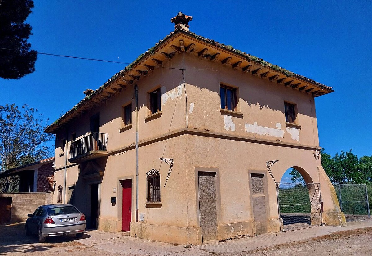
The town layout is compact and easy to walk. Narrow streets run between houses built from a mix of stone and brick, with façades in earthy tones typical of the Ribera’s domestic architecture. It is not a uniform historic ensemble. Older homes sit alongside more recent alterations and newer builds, and that contrast reveals something essential. Monteagudo has not been preserved as a museum piece; it continues to function as a working agricultural village where orchards, storage spaces and parked cars are part of everyday life.
The castle hill and the Sagrado Corazón
The hill of the castle organises the entire visual identity of Monteagudo. The fortress, of medieval origin though heavily altered over time, occupies a strategic position overlooking the plain. From here it was possible to control the routes connecting this part of the Ribera with the Queiles valley and the area around Moncayo.
Today, above the remains of the castle, stands the large image of the Sagrado Corazón. Installed in the 20th century, it has become the most recognisable symbol of the village and can be seen from several kilometres away. Its presence dominates the skyline and gives Monteagudo a distinct profile within the surrounding countryside.
The hill also works as a natural viewpoint. From the top, the fields that encircle the village stretch out in all directions. On clear days, the view extends well beyond the immediate plain, offering a broader sense of the Ribera landscape and its agricultural structure.
The church of the Asunción
Within the town, the main religious building is the church of the Asunción de Nuestra Señora. Like many parish churches that have evolved over time, it reflects different construction phases. Extensions and alterations have responded to the needs of the community across centuries.
The tower is simple in design. Inside, the church contains altarpieces and devotional images from various periods. It is not a monumental building, yet it provides a solid example of the religious heritage that has remained active in Ribera villages over long stretches of time.
Attention often falls on the polychromy of some altarpieces, as well as on smaller devotional objects. Many of these are linked to local brotherhoods or to donations made by residents, which adds another layer to the building’s role within the community.
Everyday architecture and agricultural life
In the older streets, elements of traditional domestic architecture are still visible. Wrought-iron balconies appear on upper floors, wooden eaves project over façades, and walls combine sandstone with brick. Some houses retain large entranceways designed for carts or for storing agricultural tools, a reminder of how closely daily life has been tied to the land.
Agriculture continues to set the pace of Monteagudo. At certain times of the year, tractors move in and out of the town centre, and trailers pass through carrying produce towards local cooperatives. This is part of a wider regional pattern. Monteagudo belongs to an area where irrigated farming, especially vegetables and seasonal crops, has held clear economic importance for decades.
The presence of this activity shapes the atmosphere. It is visible in the streets, in the buildings, and in the rhythms of the day. Rather than separating work and living spaces, the village integrates them.
Walking through the agricultural surroundings
The land around Monteagudo is open and relatively flat. There are no major changes in elevation, but a network of agricultural tracks links plots of land, irrigation channels and small rises. These paths make it possible to understand how the Ribera landscape is organised.
The scenery shifts noticeably with the seasons. Spring brings intense greens across the fields. After the harvest, and towards the end of summer, the tones become drier and more muted. These changes are part of the visual character of the area, reflecting the agricultural cycle rather than any dramatic geographical variation.
During the warmer months, the sun can be strong in the middle of the day. Many of the tracks offer little shade, which is worth bearing in mind when walking through the fields.
A short stop with a wider context
Monteagudo does not require much time to explore. A walk through the streets, a visit to the parish church and a climb up to the castle hill are enough to form a clear impression of the place. The experience is less about ticking off major monuments and more about understanding how a village functions within its agricultural setting.
Travellers in the Ribera often include Monteagudo as part of a broader route. The nearby Moncayo area and the villages of the Queiles valley provide a wider geographical context. Within that framework, Monteagudo offers a straightforward but revealing stop, where the connection between land, history and daily life remains visible.