Full Article
about Ibarrangelu (Ibarranguelua)
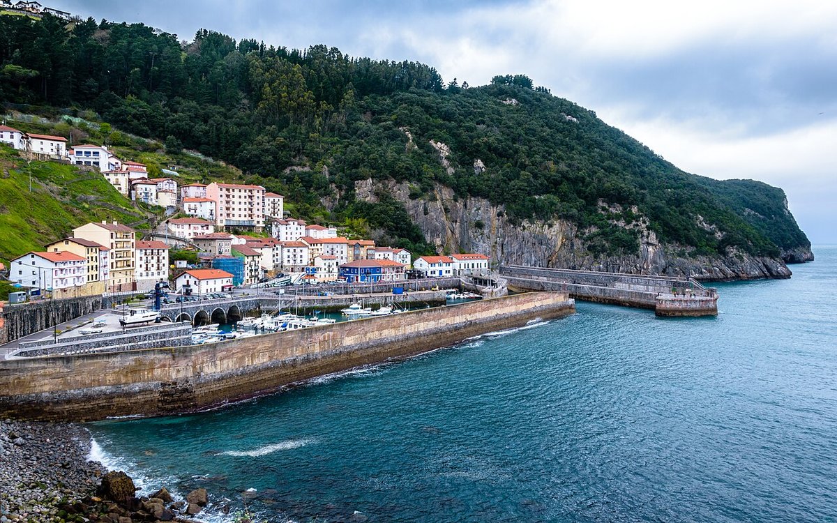
Cantabrian Sea, cliffs and seafaring flavor in the heart of the Basque Country.
Hide article Read full article
A rural strip above the Mundaka estuary
Ibarrangelu stretches along an elevated strip on the left bank of the Mundaka estuary, within what is now the Urdaibai Biosphere Reserve. Its land opens directly onto the Cantabrian Sea along one of the most exposed sections of coastline in the area. With just over six hundred residents and neighbourhoods scattered across the hills, the municipality still follows a rural pattern that has changed very little in its essentials. Farmhouses stand apart from one another, meadows slope down towards the sea, and narrow roads link small clusters of homes.
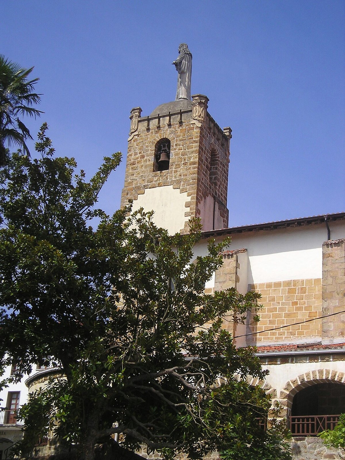
This layout reflects a long history tied to both land and nearby waters. The parish centre grew around the church of San Andrés, recorded since medieval times, when these valleys fell under the jurisdiction of the merindad of Busturia within the Lordship of Biscay. Farmhouses were established on the most fertile parts of the hillside, combining cultivation and livestock with access to the estuary and coastal resources. That dispersed settlement explains why Ibarrangelu does not have a compact urban centre today.
Landscapes shaped by hills and sea
The character of Ibarrangelu becomes clearer when moving through its neighbourhoods. Traditional houses appear separated by fields and small wooded areas. Many still follow the Biscayan farmhouse model, with stone walls, timber frames and wide roofs designed to protect both grain and animals from the damp Atlantic climate.
One of the best-known points in the surrounding area is the natural viewpoint of San Miguel de Ereñozar. At the summit stands a small hermitage dedicated to the archangel, linked to old local pilgrimages known as romerías. From this height, the shape of the Mundaka estuary is easy to read, along with the chain of marshes that define Urdaibai. The climb requires some effort, but it helps make sense of how the terrain and settlements fit together across the estuary.
To the north, the municipality reaches the beach of Laga. This stretch of sand lies between cliffs and faces the full force of the Cantabrian Sea. The tide alters its appearance significantly. At low tide, a broad expanse of sand opens up. At high tide, the space narrows and the water reaches close to the base of the hillside. This constant shift is typical of this part of the Biscayan coast, where the sea shapes the landscape in visible, everyday ways.
Moving between neighbourhoods
Much of Ibarrangelu is explored through rural paths that connect neighbourhoods and farmhouses. Some sections follow old agricultural routes once used to link farms with the estuary or nearby villages. These are not routes designed for speed. There are slopes, tight bends and stretches where the surface changes between asphalt, concrete or compacted earth.
From various points in the municipality, paths branch off towards the coast or join longer routes within Urdaibai. The scenery changes quickly over short distances. Open meadows dominate the higher ground, while patches of Cantabrian holm oak woodland appear closer to the shoreline. Near the estuary, marshland takes over, creating a different landscape again. This variety is one of the defining features of the area, even though distances are relatively small.
The absence of a single centre means that moving through Ibarrangelu is about linking places rather than arriving at one focal point. Each neighbourhood forms part of a wider whole, connected by roads that follow the contours of the land rather than cutting straight across it.
Visiting with time and patience
Ibarrangelu is not a place to approach in search of major monuments. Its appeal lies in moving slowly through its landscape, passing from one neighbourhood to another or stopping at natural viewpoints overlooking the estuary and the sea. The experience builds gradually, shaped by the rhythm of the terrain and the spacing of its homes.
The beach of Laga attracts most visitors during the summer months. When the weather is favourable, the nearby parking area tends to fill up. It is worth keeping the tides in mind before heading down to the sand, as the difference between low and high tide is considerable and changes how much space is available.
The relief of the land also influences how the area is experienced. Many local roads are narrow and sloped. Travelling between neighbourhoods or reaching certain paths takes time and a bit of patience. That is part of the logic of the place. The landscape does not present itself all at once. It unfolds gradually, curve by curve, between meadows and farmhouses, with the estuary and the sea appearing in fragments along the way.