Full Article
about Sukarrieta (Pedernales)
Cantabrian Sea, cliffs and seafaring flavor in the heart of the Basque Country.
Hide article Read full article
A small town shaped by the estuary
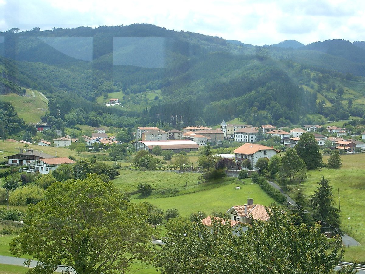
Sukarrieta sits on the eastern bank of the Mundaka estuary, within the Urdaibai Biosphere Reserve in the Basque Country. It is a very small municipality, even by local standards, with just over three hundred residents. The built-up area forms a narrow strip between the road and the water, and that layout says a lot about how the place works.
Tourism in Sukarrieta makes more sense when seen through this lens. It is not a town defined by monuments or a compact historic centre. Its identity is tied to the estuary itself. Nearby Mundaka and, further inland, Gernika provide the historical reference points, while Sukarrieta has long been linked to everyday activity along the water: fishing, small-scale rural work, and later the arrival of second homes. That mix explains the look of the town today.
There is no single old quarter to walk through. Houses line the estuary or appear in small clusters, many of them following the model of renovated Basque rural homes, with light-coloured walls and sloping roofs. Between them are narrow passages leading down to the water and small jetties that keep the connection with the estuary close at hand.
Tides and birdlife in Urdaibai
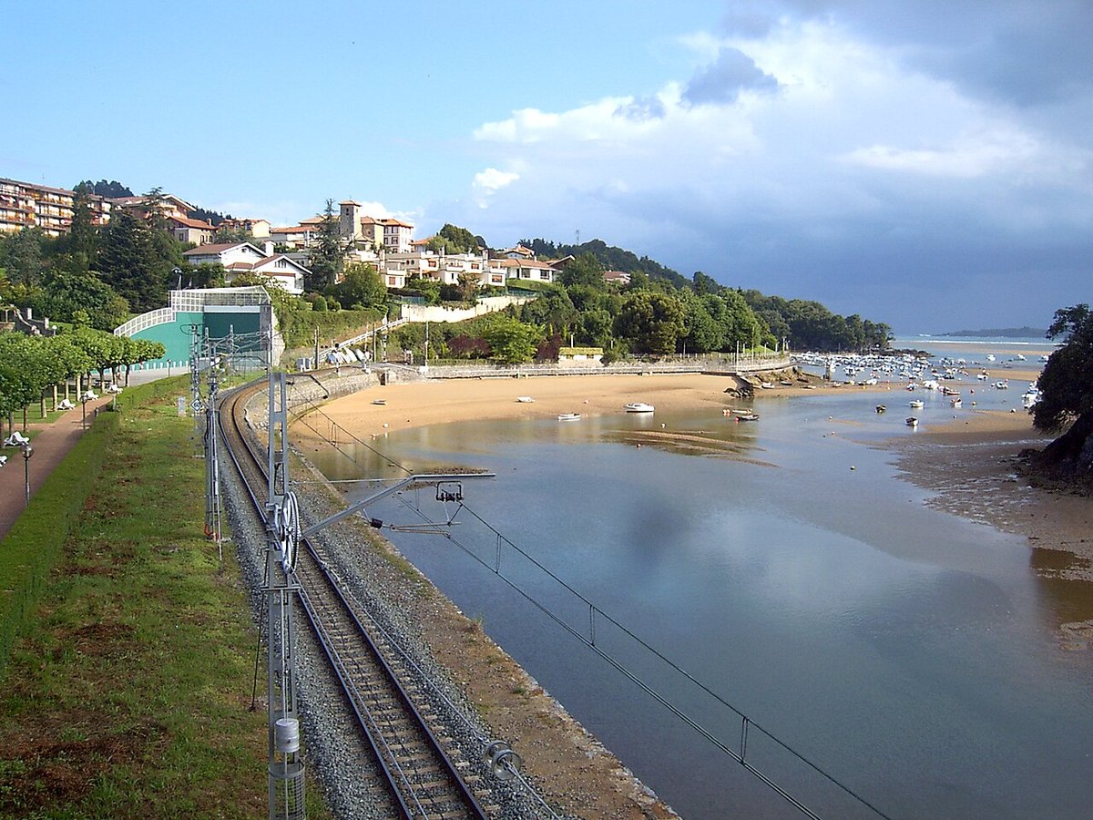
The main point of interest lies in the surrounding marshes of Urdaibai. The Mundaka estuary changes noticeably between high and low tide, and that shift shapes what can be seen.
At low tide, the water recedes to reveal wide stretches of mud crossed by narrow channels. This is when wading birds and other species are easiest to spot as they feed across the exposed surfaces. The landscape feels more intricate, with lines and textures that only appear when the tide is out.
At high tide, the scene simplifies. Water covers the marshes and the estuary becomes a more uniform surface. For anyone watching birds, the timing of the tides makes a clear difference to what is visible at any given moment.
There is often movement during migration periods. Even without binoculars, it is possible to notice activity along the estuary from the shore, though identifying species is not always straightforward. The sense of constant change is part of what defines the place.
Walking through the town
Sukarrieta can be explored in a short time. Most of it is organised around the road that runs alongside the estuary, with short streets branching off towards the water.
There are no large viewpoints or designed lookouts. Views appear between houses, beside simple benches or next to modest jetties. The landscape is low and horizontal, with the estuary filling much of the field of vision.
In the evening, light usually comes in from the west and falls across the marshes. The setting itself remains the same, but the tone of the water and the exposed mud shifts with the light, giving the area a different feel without changing its basic form.
Txatxarramendi Island
Just opposite the town lies the island of Txatxarramendi. It is now connected by a small access point, though crossing depends partly on the tide and current conditions.
The island is low and elongated, with short paths running through meadows and a scattering of trees. From here, the shape of the estuary becomes clearer, as does the relationship between Sukarrieta, Mundaka and the inner marshes.
The walk is brief. Rather than a destination in its own right, the island works as an extension of a stroll through the town, offering a slightly wider perspective over the estuary.
Paths across Urdaibai
Sukarrieta sits within the network of walking routes that cross Urdaibai. Some paths follow the estuary towards Mundaka, keeping close to the water. Others head inland in the direction of Gernika.
The terrain in this area is generally moderate, though distances can stretch if rural detours are taken. Along the estuary, it is common to see small boats and, at certain times, people moving across the water in kayaks or on boards. Conditions on the water can vary, so it is sensible to be aware of currents, tides and other traffic before setting out.
These paths reinforce the sense that Sukarrieta is part of a wider landscape rather than a self-contained destination. The estuary links everything together, both visually and in terms of movement.
What to expect before arriving
Sukarrieta is not a place to visit in search of specific buildings or landmarks. Its scale is small, and the main interest lies in the estuary and the nearby marshes.
In the space of a morning, it is possible to walk through the town, reach the island if access allows, and follow a short stretch of path along the water. The experience depends largely on how much time is spent observing the estuary and its changes.
Photographs often isolate the landscape, but on the ground there are also everyday elements: the road, newer houses, and the practical details of a lived-in place. These do not disappear, and they form part of the overall impression.
If you only have two hours
With limited time, it makes sense to leave the car near the centre and continue on foot. A walk along the estuary is enough to see how the landscape shifts with the tide.
If access to Txatxarramendi is open, crossing over adds another viewpoint across the estuary. Even including the island, the full route remains short and manageable within a brief visit.
Common mistakes
The most frequent issue relates to the tides. Reaching Txatxarramendi without checking water levels can restrict access or alter the intended route.
Another common pattern is staying on the main road and leaving quickly. Walking just a few minutes towards the shoreline gives a clearer sense of how the town relates to the estuary.
Some streets are narrow in places, so it is worth parking without blocking access and continuing on foot. In a town of this size, everything is close enough to reach easily.