Full Article
about Asparrena
Deep green, farmhouses and nearby mountains with trails and viewpoints.
Hide article Read full article
A place that doesn’t try to impress
Some places are planned destinations. Others you reach almost by accident, because they are on the way or because someone said, “stop there for a moment”. Tourism in Asparrena often works like that. There is no big sign announcing anything remarkable. Yet when you step out of the car in Araia and look around, the place makes sense in its own quiet way. Open fields, mountains close by, and villages that still function as real communities rather than visitor hubs.
Asparrena sits in the Llanada Alavesa, right up against the mountain ranges that separate Álava from Gipuzkoa and Navarra. Life here has long revolved around farming and the surrounding hills. It has not reshaped itself for visitors. If anything, it is the visitor who adjusts to the rhythm of the place.
Araia, where everything begins
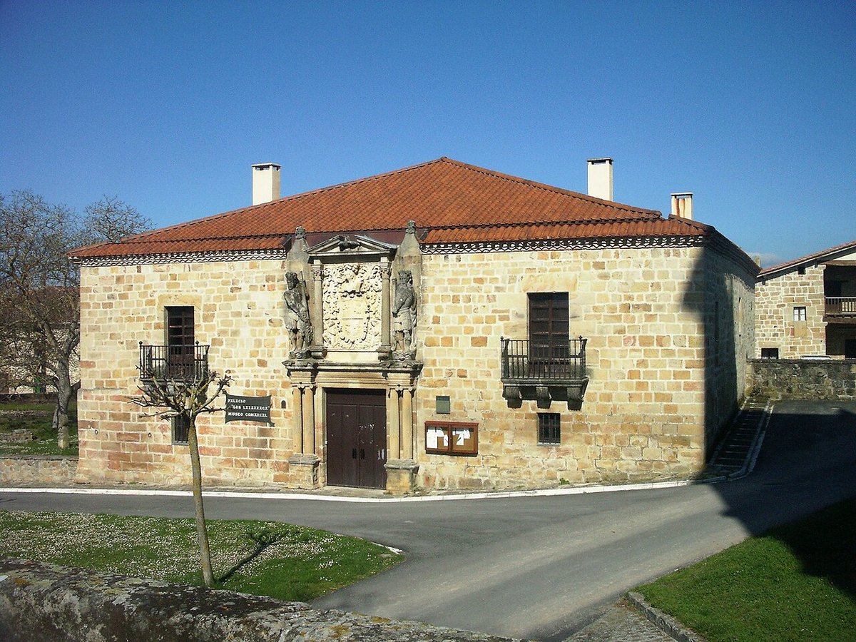
Most visits naturally start in Araia, the main settlement in the municipality. It is not large, though it carries the feel of a place that has seen people pass through for centuries. Stone houses line the streets, some carefully restored, others marked by the wear of long winters.
There is no need to plan a route through the village. The streets are straightforward and quickly covered. What matters lies in the details: large farmhouse gates, courtyards where logs are still stacked for winter, façades that combine old stone with more recent alterations.
At the centre stands the parish church, easy to spot as you walk through. Like many churches in this part of northern Spain, it is often closed outside religious hours. If you happen to find it open, the interior is restrained. There is no sense of grandeur, just a simple, functional space that reflects the wider character of the area.
Mountains always in view: Aizkorri and Urkilla
One of the most noticeable things in Asparrena is the constant presence of the mountains. Look north from almost anywhere and the slopes of the Aizkorri and Urkilla ranges come into view.
Several paths begin in Araia and lead towards these hills. Some are marked, linking up with longer routes inside the natural park. Others are simply forest tracks used by farmers, hikers or local residents heading out for a walk.
You can tell when a landscape works without effort. There is no need for a designated viewpoint. It happens naturally. Walking along any path, you look up and see meadows, beech forests, and on a clear day the outline of the peaks in the distance. The setting does not present itself as a spectacle, yet it stays with you.
The smaller villages across the valley
Asparrena is more than Araia. The municipality includes several smaller villages spread across the valley, including Egino, Ilarduia and Andoin. Each follows a similar pattern: a church, a frontón, which is a traditional Basque court for pelota, and a small cluster of houses.
These are places where little seems to happen, and that is precisely why they have retained their character. The streets are not arranged for sightseeing. There are no defined routes or attractions to tick off. You pass through slowly and continue on.
Egino, for instance, is well known among hikers. Routes towards higher parts of the sierra begin there, and at weekends you are more likely to see people with backpacks and walking boots than visitors taking photographs. The activity feels tied to the landscape rather than organised around tourism.
Rural paths and a working landscape
Much of what defines Asparrena lies outside its villages. Paths run between fields, low stone walls mark boundaries, and pastures are often occupied by sheep or cattle.
After several days of rain, which is fairly common in this part of the Basque Country, some of these paths become challenging. Mud, puddles and loose stones are part of the experience. Proper footwear makes a difference if you plan to walk for any length of time.
In return, there is a strong sense that the landscape is still in use. This is not a backdrop arranged for visitors. Tractors pass along tracks, people repair fences, and dogs move livestock from one field to another. Everyday work continues whether anyone is watching or not.
A short visit that still leaves an impression
Asparrena is not a place designed to fill an entire weekend with planned visits, and there is no need to pretend otherwise. In a few hours, you can walk through Araia, visit one of the nearby villages, and head out towards the mountains for a short walk.
It works well as a pause in a longer journey. You arrive, spend some time walking, take in the combination of open valley and nearby hills, and then continue through the Llanada Alavesa or towards the surrounding sierras.
It is the kind of place that does not try to impress. Yet when you leave, the landscape tends to linger in your mind a little longer than expected. That, in itself, says quite a lot.