Full Article
about Donemiliaga (San Millán)
Deep green, farmhouses and nearby mountains with trails and viewpoints.
Hide article Read full article
A landscape that sets the tone
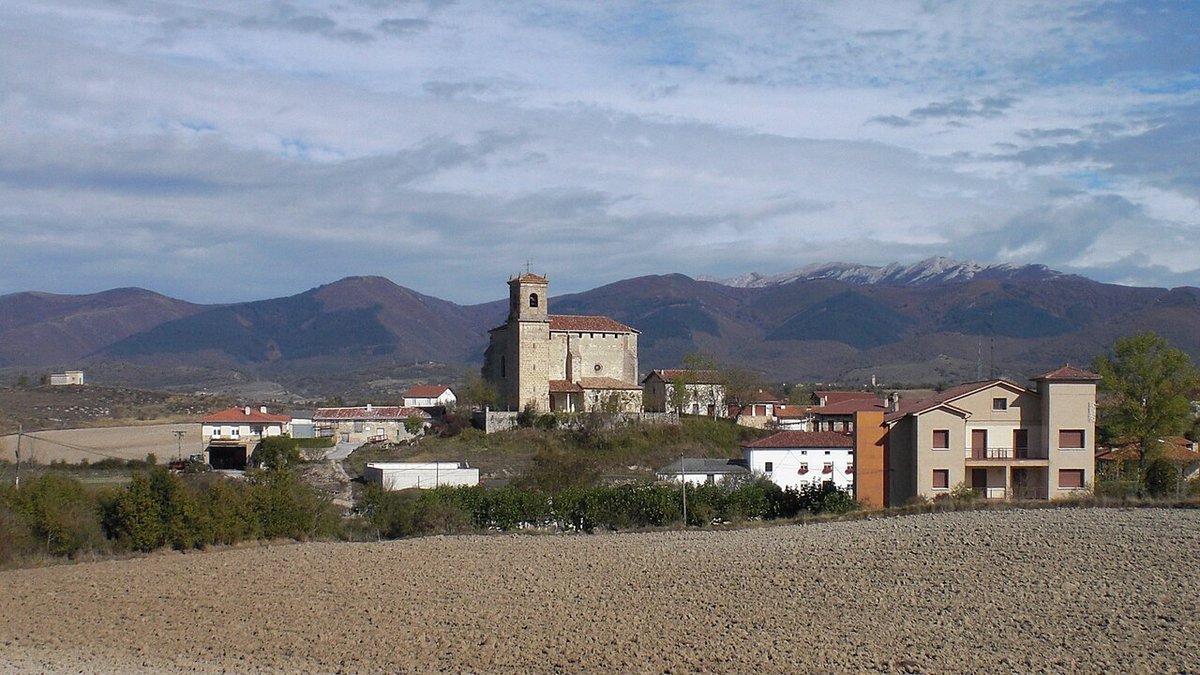
Any look at Donemiliaga starts with the Llanada Alavesa. This municipality sits in the eastern part of that plain, within the Cuadrilla de Salvatierra, an open agricultural area where settlements never grew very large and where the landscape has changed less than it might seem. Just over seven hundred people live here, spread across several small communities. That scattered pattern explains much about how the place works.
The name San Millán, Donemiliaga in Basque, already appears in medieval documents. In the so called Voto de San Millán and in the Reja de San Millán of 1025, a tax record from the Kingdom of Pamplona, several villages from this area are listed as paying tribute to the monastery of San Millán de la Cogolla in La Rioja. Those texts do not describe the land itself, but they make one thing clear: many of today’s small villages have been continuously inhabited for over a thousand years.
A municipality of small councils
Donemiliaga is not a single compact town. It is made up of several small settlements, each with its own church, square and local council, known as a concejo. This structure is common in Álava and goes back to the medieval organisation of the territory.
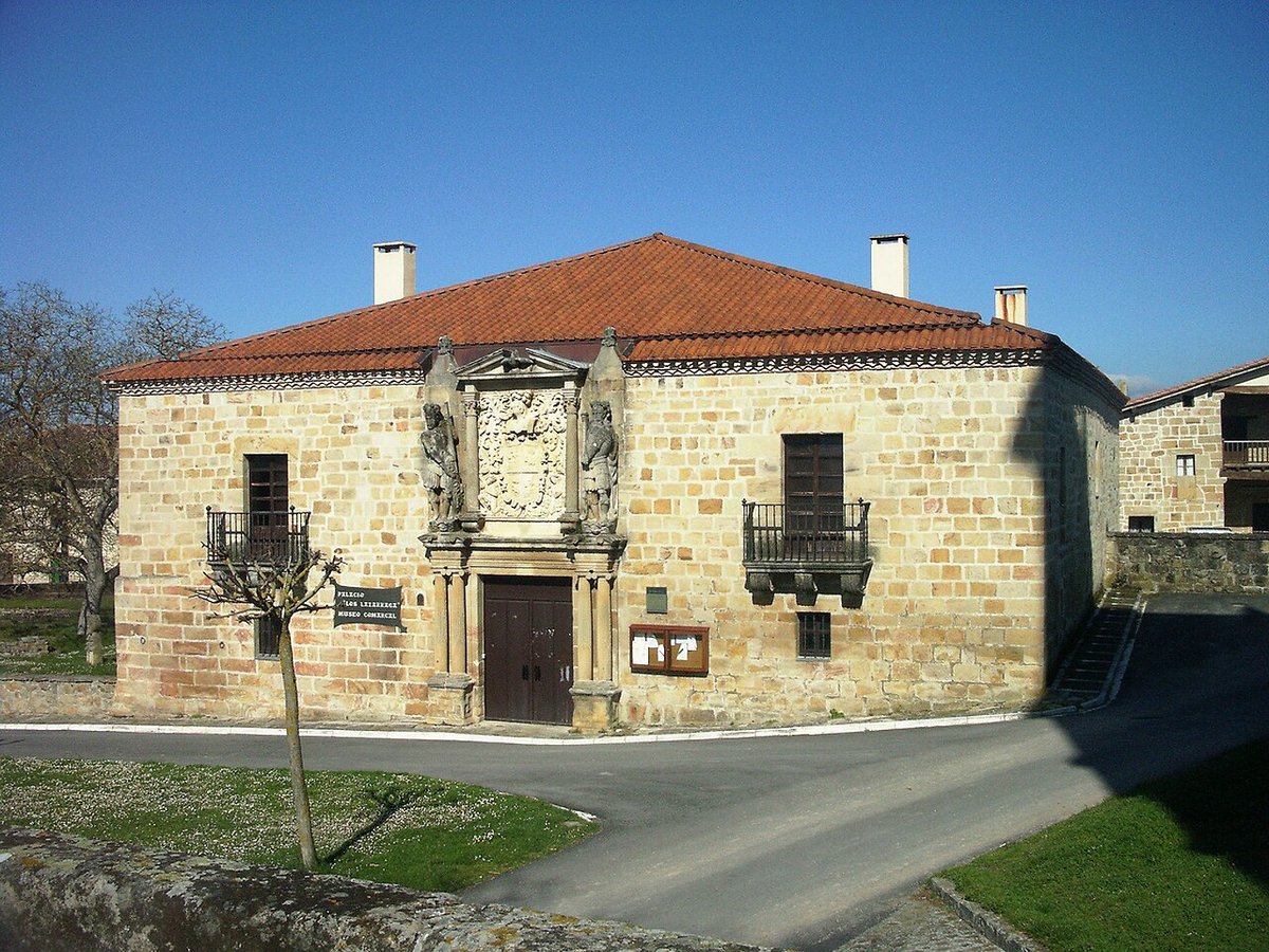
San Millán gives its name to the municipality and acts as an administrative reference point, yet daily life is spread across nearby villages. Houses tend to line a main street or gather around a small square. Stone is the dominant material, visible in walls and doorways, with many buildings dating from the 16th to 18th centuries and later altered. Some lintels display family coats of arms. These do not always signal nobility, and can simply point to long established households with a certain standing in the community.
The parish church of San Millán reflects a similar process. The current building is largely from the early modern period, constructed over an earlier structure. Across the Llanada, many parishes followed this pattern in the 16th and 17th centuries, when communities expanded medieval churches that had become too small. Their importance lies less in their size than in their role as the symbolic centre of each concejo.
Old routes across working land
Beyond the villages stretches the characteristic landscape of the Llanada. Broad plots of farmland, straight agricultural tracks and small patches of trees define the view. Today the land is mainly used for cereal, potatoes and fodder, though its use has shifted several times over the 20th century.
Many of the paths now used for walking or farm vehicles follow much older routes. For centuries they linked neighbouring villages, grazing areas and shared land. They were not created for leisure, but for daily work and the movement of livestock.
At certain crossroads or on slight rises, small rural chapels appear. These ermitas were usually linked to nearby parishes and served specific religious purposes such as pilgrimages, prayers for rain or celebrations tied to the agricultural calendar. Even if they remain closed much of the time today, they help explain how collective life in the countryside was organised.
A rhythm that can be seen
In small villages, shared spaces reveal a great deal about how the community functions. The frontón, the Basque pelota court, and the square beside the church are still regular meeting points. There does not need to be a match for someone to stop by, exchange a few words or simply watch who passes.
Distances between the concejos are short. By car they take only a few minutes, and on foot some stretches can be linked using agricultural tracks. The terrain is mostly flat, with gentle undulations that allow wide views across the valley.
A place for a quiet look around
Donemiliaga does not have a single monumental centre or a clearly defined sightseeing route. Visiting usually means moving between different concejos and taking time to observe how they are built and arranged.
Attention naturally falls on stone doorways, coats of arms on certain façades and the close relationship between houses and the surrounding fields. That direct connection with the land has historically shaped this part of Álava.
With fair weather, walking a short distance along the paths that leave each village is enough to grasp the setting: a wide agricultural plain, small settlements and a territorial organisation that, despite changes, still echoes what appears in medieval records.