Full Article
about Otxandio (Ochandiano)
Deep green, farmhouses and nearby mountains with trails and viewpoints.
Hide article Read full article
A village on the watershed
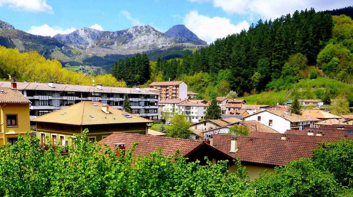
Otxandio sits at 554 metres above sea level in the Duranguesado, directly on the divide between the Cantabrian and Mediterranean basins. This isn’t a symbolic line; the rainwater that falls on one side of its streets eventually reaches the Cantabrian Sea, while on the other, it flows toward the Ebro. With just over 1,300 inhabitants, it belongs to a landscape of historic passage points, a role that still defines its character.
The surrounding terrain is typical of the Basque mid-mountain range. Beech and oak woods cover the slopes, but the defining feature is the network of enclosed meadows, their stone walls built to last. This is a working landscape, shaped by a livestock economy that remains active. The fields you see are not a backdrop.
Historically, Otxandio’s position made it a crossroads for routes into Álava or deeper into Bizkaia. Many of those old paths survive, now serving as walking trails or rural tracks that cut across the municipality.
A centre shaped by its history
The village core developed around the church of San Miguel Arcángel. Built in the 16th century and altered later, its tower is a visual anchor, visible from various points in the valley. The settlement logically grew around this fixed point.
The adjoining square functions as the civic heart. It’s not large, but it gathers several notable buildings and is where local life converges during festivals. This same space holds a darker memory: it was bombed on a festive day at the start of the Spanish Civil War. A simple plaque now marks the event, a quiet testament in an otherwise ordinary square.
A short walk reveals several manor houses and former palaces, some with coats of arms and carved stone doorways still visible on their façades. They don’t form a continuous historic quarter, but they indicate the village’s administrative role in the area between the 16th and 18th centuries.
Beyond this compact centre, the structure dissolves into scattered caseríos, the traditional Basque farmhouses. Their masonry walls, tile roofs, and large doors designed for livestock speak of a persistent agricultural reality. The activity around them is not staged.
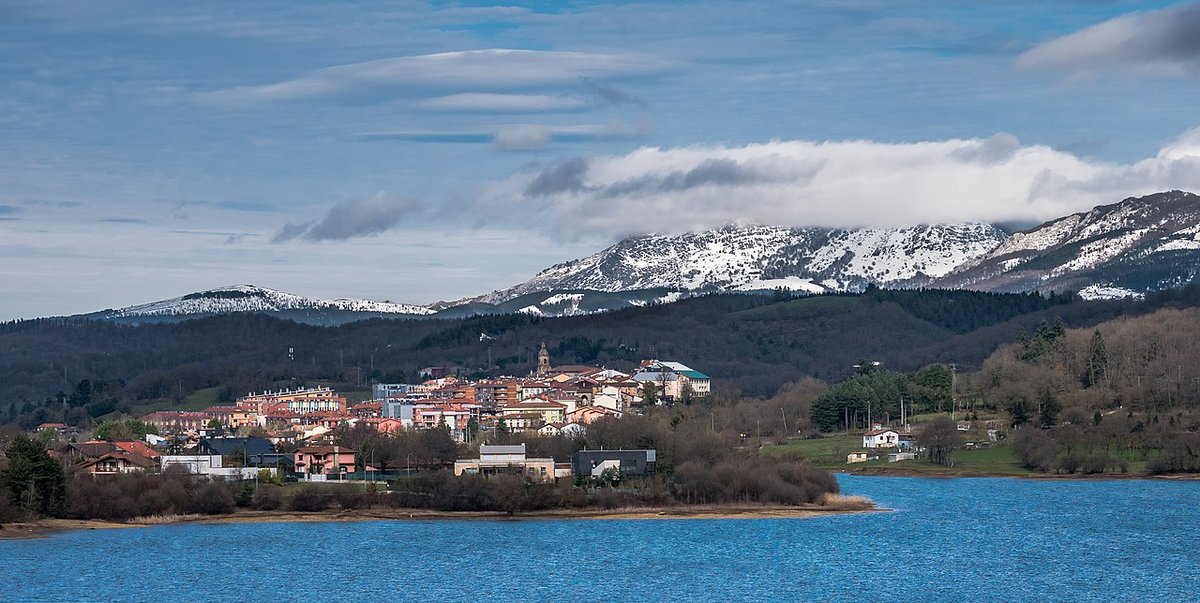
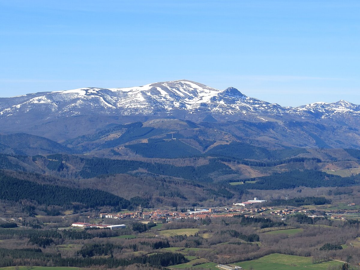
The presence of Anboto
The outline of Otxandio is framed by mountains, primarily the Anboto massif to the south and the Udalaitz range. While the village sits in a valley, the terrain rises sharply at its edges.
Anboto is more than a silhouette. In Basque mythology, its caves are the dwelling of Mari, a central figure in local folklore. This cultural weight means the mountain is rarely mentioned just as a geographic feature; it carries a symbolic presence that surfaces in local references.
The forests here change decisively with the seasons. Autumn turns the beech woods a deep rust, while winter often brings dense fog that settles in the valley for days, blurring the lines between village and mountain.
Paths and practical terrain
To understand Otxandio, you walk out of it. Trails start at the edge of the streets, leading into meadows or woodland within minutes. The transition from built space to open countryside is abrupt.
The terrain demands attention. As in much of inland Bizkaia, paths can be slick after rain—a consistent factor that shapes the experience of walking here. Proper footwear is a practical consideration, not an afterthought.
The secondary roads that loop around the municipality are also used by cyclists. Traffic is generally light, but the routes are characterised by tight bends and constant changes in gradient. A mountain or gravel bike is better suited here than a road bike.
These routes, whether walked or cycled, often trace the historical paths that once connected villages. Using them provides a tangible sense of how this place has always been linked to its surroundings.
A stop in the Duranguesado
The village centre can be seen in under an hour. The church, the square, and a few surrounding streets contain its most visible elements. Otxandio functions less as a destination in itself and more as a starting point for walks or a pause within a broader exploration of the Duranguesado.
Weather dictates plans here. Fog and rain are common, and conditions can shift quickly, especially with the surrounding topography. An afternoon can turn cold well before sunset.
With limited time, a straightforward route suffices: cross the square, visit the church, then take any street leading east or west toward the outskirts. Within five minutes, you’ll be at the edge of meadows with the hills rising ahead. On a clear day, the profile of Anboto anchors the southern view, a constant reminder of the landscape that defines this place.