Full Article
about Zegama (Cegama)
Deep green, farmhouses, nearby mountains with trails and viewpoints.
Hide article Read full article
First light at the foot of Aizkorri
Early in the morning, at the entrance to the village, stone houses and damp meadows still hold the sheen of dew. Light filters cautiously through the trees and settles on the slopes of Aizkorri, which at that hour carry a cold, almost metallic grey. At that moment, tourism in Zegama feels far away. There is little to hear beyond sheep shifting slowly through the grass and the occasional creak of a branch when the wind picks up.
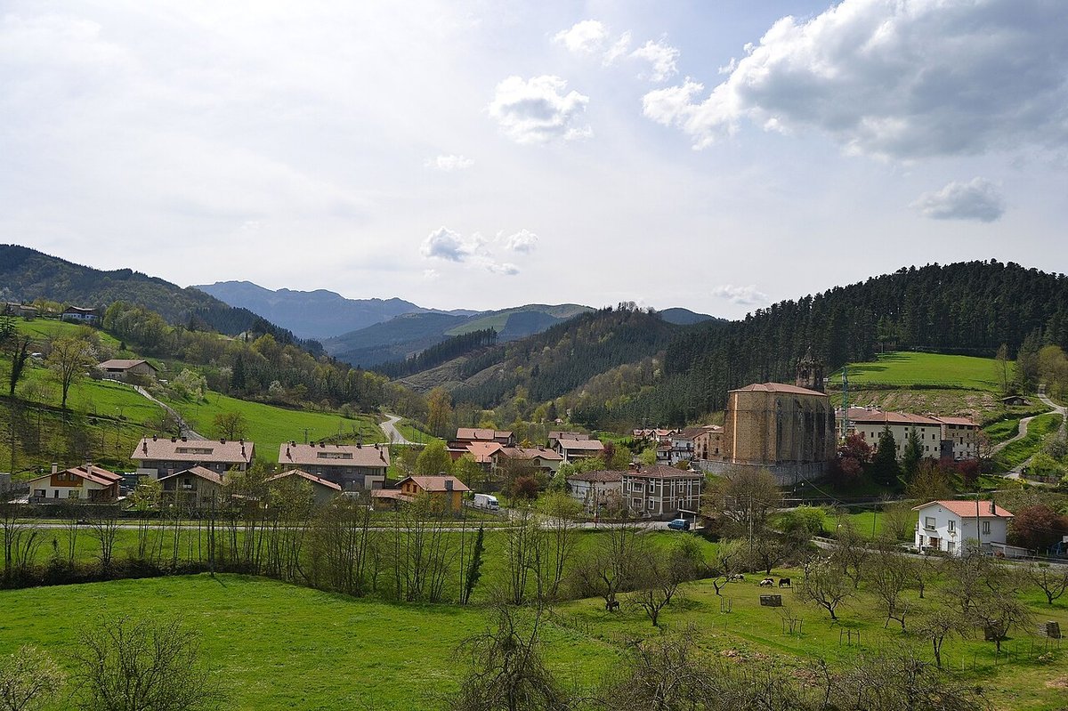
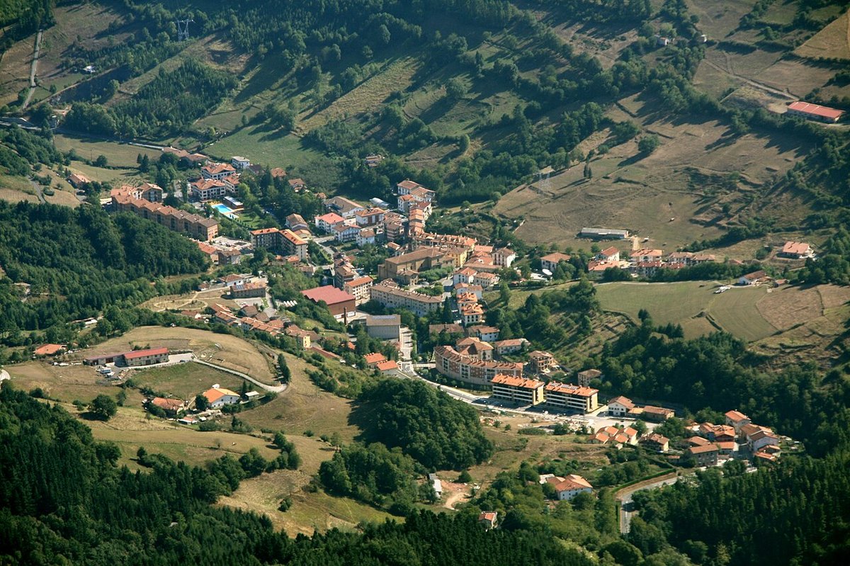
Zegama sits in the Goierri region, at the foot of the Aizkorri mountain range. From the road, the setting becomes clear almost immediately: a valley enclosed by limestone walls, intensely green fields and scattered caseríos, the traditional Basque farmhouses, spread across the hillsides. Within minutes of leaving the centre, the terrain begins to rise. This is not a landscape designed to be admired from a distance. It is meant to be walked.
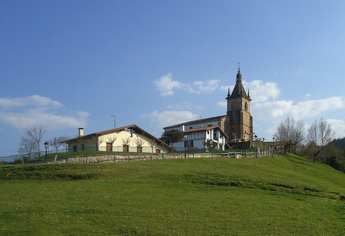
A small village, lived in at its own pace
The centre of Zegama is compact and easy to explore without hurry. Short streets, stone buildings with wooden balconies, and the occasional wide entrance where tools or tractors are still kept. The church of San Martín de Tours stands at the heart of it all, sober in appearance and more solid than decorative.
Around the village core, enclosed meadows continue to appear, along with paths that lead down towards the Oria river. On damp days, the air carries the smell of freshly cut grass and wet wood, a scent that feels typical of this part of Gipuzkoa.
Zegama does not operate as a staged destination. Everyday life remains clearly visible. Cars are parked outside farmhouses, neighbours cross the square carrying bread, and tractors move slowly through the streets. Nothing seems arranged for visitors, and that is precisely what defines the place.
The path towards the San Adrián tunnel
A few kilometres away lies one of the best-known historic passages in the area: the San Adrián tunnel. This is not a modern construction but a natural opening in the rock that served for centuries as a route between Gipuzkoa and Álava.
Inside, there is a small hermitage. When it is quiet, the echo of footsteps bounces off the damp walls. The atmosphere shifts depending on the weather. On foggy days, the space feels enclosed and hushed. When sunlight enters from both ends, the textures of the rock and the traces of the old path become more visible.
Access is usually on foot, via mountain trails or forest tracks. Some stretches are uneven, with loose stones, and there are areas where the ground stays wet for long periods. Even on dry days, good footwear with a solid sole is advisable.
Walking into Aizkorri
Zegama is one of the usual starting points for heading into the Aizkorri range. Routes from here lead towards several well-known peaks in the massif, including Aitxuri, which reaches around 1,550 metres and is among the highest points in the Basque Country.
These are not gentle walks. There are steep sections, irregular limestone terrain and weather that can change quickly. Fog can appear within minutes and obscure the landscape, something that happens frequently in this range.
There are also quieter paths around the caseríos near the village. These shorter routes cross meadows and beech woods, where the dominant sounds are the bells of grazing livestock and water running through small streams. The pace here is slower, closer to the ground, and shaped by the immediate surroundings rather than distant views.
When runners take over the streets
Among mountain enthusiasts, Zegama is widely known for a trail race that usually takes place at the end of May. Over that weekend, the atmosphere changes noticeably. Runners arrive from many places, and the streets fill with people from early in the day.
Outside those dates, the village returns to its usual rhythm. Anyone looking for quiet time in the mountains will find the rest of the year far calmer.
Choosing the moment and reading the landscape
Spring and autumn tend to be the most rewarding times to walk in the area. In spring, the meadows are at their most vibrant and water flows strongly through the small streams. In autumn, the beech forests on the slopes of Aizkorri shift in colour, and the ground fills with damp leaves that crunch underfoot.
It is worth checking the weather before heading up towards Aizkorri. When fog rolls in or strong winds blow down from the range, conditions can change quickly and visibility in higher areas can drop significantly.
If the day begins under low cloud, staying closer to the valley can be a better choice. Walking between caseríos, following a forest track, or heading calmly towards the surroundings of San Adrián offers a different perspective. In Zegama, some of the most interesting moments happen at ground level, among wet grass and paths that fade into the forest.