Full Article
about Trapagaran (Valle de Trápaga)
Valleys and hamlets a stone’s throw from Bilbao, buzzing with local life.
Hide article Read full article
Between the estuary and the mines
Set between the Bilbao estuary and the Triano mountains, Trapagaran grew around one of the largest mining areas in Bizkaia. Iron lay close to the surface here. The ground only needed to be opened. That simple condition shaped everything that followed.
By the late nineteenth century, the valley had filled with galleries, loading structures and working-class neighbourhoods. Their imprint has not faded. The landscape still carries the marks of that intense period, where extraction and daily life existed side by side.
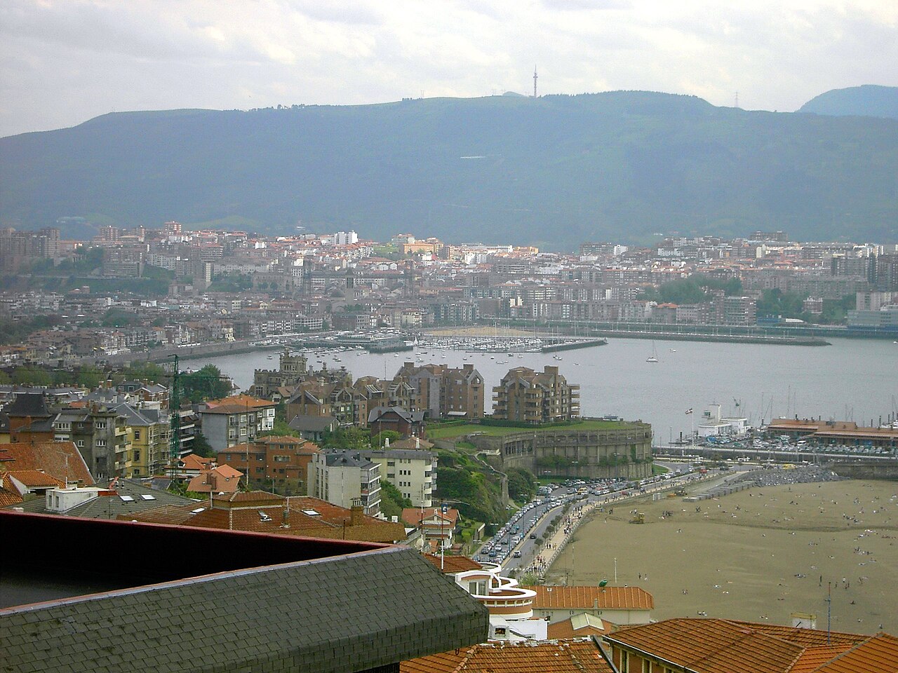
The La Reineta funicular makes this geography easy to grasp. It starts at the bottom of the valley and climbs steeply in just a few minutes to the upper area, where the mining landscape of La Arboleda opens out. From above, the logic becomes clear: hills carved out by extraction, lagoons that were once open pits, and in the distance the estuary that linked all this iron to the blast furnaces.
The system still operates using the classic counterweight principle. One carriage rises as the other descends. It was built as working infrastructure, not as a leisure attraction, and that purpose is still evident in how it functions.
Iron and a living memory
Trapagaran cannot be understood without its connection to iron. The Triano mountains were already being worked in earlier periods, though the major transformation arrived with industrialisation. Between the late nineteenth century and the early decades of the twentieth, La Arboleda developed into a fully formed mining settlement.
Schools, workers’ stores and housing appeared to support daily life. Many of those brick houses are still standing, now mixed with later buildings. The layout of the neighbourhood continues to reflect that industrial organisation, with its clear sense of function and proximity to the sites of work.
This was also a place where labour movements became particularly active. Dolores Ibárruri, known as La Pasionaria, spent part of her youth in this mining area before becoming a central political figure in twentieth-century Spain. Her presence is one thread in a wider story of social tension and collective organisation.
The memory of labour, and of conflict, remains close to the surface in the valley. It is not presented as something distant or abstract. It is embedded in the streets, in the buildings, and in the shape of the land itself.
From open pits to quiet water
When mining activity came to an end, many of the open-air workings were left behind. Over time, they filled with water. What remains today are small lagoons edged with vegetation.
The contrast is striking. Places once dominated by machinery and spoil heaps are now crossed by paths where people walk or sit by the water. Some of the shorelines carry a reddish tone, a reminder of the iron that still defines the soil.
Walking around La Arboleda makes it possible to read this transformation quite clearly. Paths pass by former ore-washing installations, and slopes that appear natural at first glance reveal themselves as old spoil heaps now covered in grass.
There is no sharp division between past and present here. The same ground holds both. The industrial layer has not been erased, only softened and adapted.
The route to the Tres Cruces
From La Arboleda, a path known as the Ruta de las Tres Cruces climbs gradually towards a ridge. From there, much of the estuary and the industrial belt around Bilbao can be seen.
The route is not technical, though it does offer insight into how mining once operated. Many of the bends in the path follow former working tracks, traces of the routes once used to move materials and people across the terrain.
At the top stand three iron crosses. Their meaning is less about religion and more about collective memory tied to the mining world. In this area, tributes to workers who died or to fellow members of a crew were a common gesture.
The setting reinforces that sense of remembrance. The crosses are simple, direct, and placed within a landscape shaped by effort and risk. The view extends outward, but the focus remains rooted in what happened here.
A working funicular, not a relic
The La Reineta funicular continues to serve as a connection between the valley and the upper area. It has retained older details, including wooden benches and a manual braking system.
At the top, a small natural viewpoint offers a clear perspective over the valley. The motorway cuts across the scene, and beyond it lies the estuary that once carried iron towards the steel industry. Bilbao is close, yet the story told by this landscape is different.
This is not a preserved industrial site set apart from everyday life. The funicular still performs its original function, linking levels of the same territory that developed for practical reasons.
Finding your way through Trapagaran
Trapagaran is easy to navigate. The valley holds the more urban areas, while La Arboleda and the surrounding hills contain the mining landscape.
Taking the funicular up and then walking the paths across the upper area offers a clear way to understand the whole. Comfortable footwear is useful, as many of the paths still have the stony ground of former workings.
Most visits begin from Bilbao, whether by car or public transport, and tend to take half a day or a relaxed full day. Trapagaran is not defined by monumental buildings. It is a place where the landscape itself explains its history. A short walk is enough to start seeing how it all fits together.