Full Article
about Santiso
Hide article Read full article
A Parish Geography
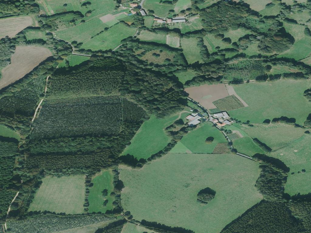
Santiso is a municipality of parishes, not a town. It lies inland in the comarca of Arzúa, away from the main roads that cross Galicia. There is no central plaza or single nucleus; life is distributed across a dozen small villages, each historically anchored to its parish church and surrounded by enclosed meadows known as leiras. The territory makes sense when you understand it as a collection of these small, self-contained communities.
This structure has deep roots. Much of the land here was once under the domain of the monastery of Sobrado dos Monxes, which from the Middle Ages organised agriculture, rents, and local administration across this part of inland A Coruña. The resulting pattern of dispersed settlement and a focus on livestock farming has endured.
Land, Work and Built Form
The terrain is one of soft, rolling hills that descend towards the valley of the river Furelos. The view from any minor road is one of pasture, with dairy cattle as the dominant presence. Around the farmsteads, you’ll see plots of maize, grelos, and kitchen gardens.
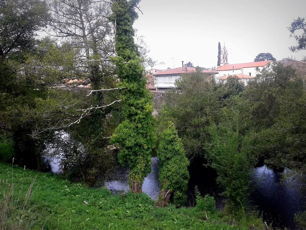
The architecture follows this agricultural logic. Homes are built from local granite, with tile roofs and an hórreo—a raised granary—almost always standing close by. These are not ornamental; they were, and often still are, essential for storing grain above ground, safe from damp and rodents. The church of San Martín in the parish of Ferreiros dates from the 16th century, though its walls show signs of earlier work and later modification. It sits among houses, part of the daily fabric rather than set apart as a monument.
Scattered Details
You don’t come to Santiso for a monumental site. Its points of interest are scattered and emerge along the minor roads. In Piñeiro, several older houses retain south-facing wooden galleries, or corredores. Their design had a practical purpose: to catch the sun for drying maize and other harvests.
In Santa María de Mezonzo and other parishes, you’ll find small stone crosses and chapels at crossroads. These cruceiros often mark historical meeting points of parish paths, serving as waymarkers and spaces for local devotion. Individually modest, together these elements sketch a portrait of a community organised around its parish.
The River Furelos
The river Furelos runs south through the municipality. Its banks, lined with willows and alders, offer a different, more enclosed atmosphere than the open fields. The remains of old water mills, or muíños, are visible here. Some are little more than stone fragments in the undergrowth; others retain partial walls and the channel that diverted water to the wheel. These were communal assets, used in turn by families from nearby villages to grind grain.
There is no formal, signposted trail along the river. Access is via farm tracks or small bridges, and walking here feels like a brief diversion into a working landscape, not a curated route. The mills are a physical reminder of an economy based on shared water rights and collective use.
Moving Through the Parishes
A car is necessary to move between the parishes. The experience is one of short journeys from one small cluster of houses to another. Once there, the best way to understand the place is on foot, following the tracks that lead past farms and fields. Many of these lanes are narrow and can be muddy after rain.
A visit typically focuses on one or two parishes. Ferreiros provides a clear example of how church, hórreos, and farmsteads relate to one another. From there, you can follow paths directly into the countryside. Digital maps are helpful for orientation, as signposting at track junctions is minimal.
A Seasonal Rhythm
Spring and autumn are the most comfortable seasons for walking here, when the agricultural activity in the fields is most visible. Summer heat is tempered somewhat along the shaded stretches of the river. In winter, the rhythm slows considerably. Days are short, limiting exploration, but the essential, quiet character of this rural Galicia becomes unmistakable.